IMAGE
The Ottoman Empire
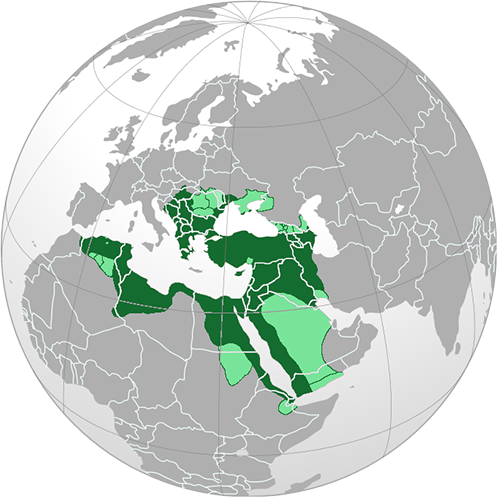
Description
The Ottoman Empire began in the fourteenth century and ended in the early twentieth century, and controlled much Western Asia, Southeastern Europe, and parts of North Africa. The Ottomans closed their borders to land trade during the bubonic plague in the fifteenth century.
Object ID
03.01.02
Citation (Chicago-style 18th Edition)
Siksok
.
The Ottoman Empire
.
https://commons.wikimedia.org/wiki/File:Ottoman_empire_largest_borders_map.png
.
Multimedia details
Creator
Siksok
Publisher
Wikipedia
Type
Image
Format
Map
File Format
png
Source
Wikipedia
Licensor
Siksok
MUMI Number
03.01.IMG.002
Creator
Siksok
Publisher
Wikipedia
Type
Image
Format
Map
File Format
png
Source
Wikipedia
Licensor
Siksok
MUMI Number
03.01.IMG.002
Creative Commons
CC BY-NC-SA 4.0 Attribution-NonCommercial-ShareAlike 4.0 International
This license enables reusers to distribute, remix, adapt, and build upon the material in any medium or format for noncommercial purposes only ifattribution is given to the creator. If you remix, adapt, or build upon the material, you must license the modified material under the same or a compatible license. CC BY-NC-SA includes the following elements:
- Attribution – Credit must be given to you, the creator.
- NonCommercial – Only noncommercial use of your work is permitted. Noncommercial means not primarily intended for or directed towards commercial advantage or monetary compensation.
- ShareAlike – Adaptations must be shared under the same terms.