



IMAGE
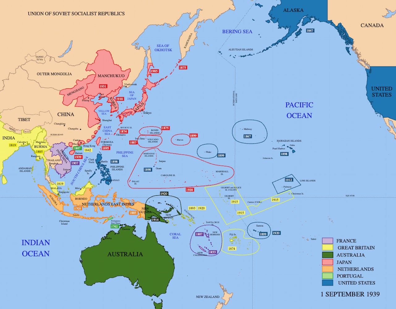
A Map of the Imperial Powers of the Pacific, 1939
Object ID
32.02.02
Citation (Chicago-style 18th Edition)
Emok
.
A Map of the Imperial Powers of the Pacific, 1939
.
2008-08-01
.
https://commons.wikimedia.org/wiki/File:Pacific_Area_-_The_Imperial_Powers_1939_-_Map.svg
.
Multimedia details
Creator
Emok
Publisher
Wikimedia Commons
Date
2008-08-01
Type
Image
Format
Map
File Format
jpg
Source
Wikimedia Commons
Licensor
Emok
MUMI Number
32.02.IMG.007
Creator
Emok
Publisher
Wikimedia Commons
Date
2008-08-01
Type
Image
Format
Map
File Format
jpg
Source
Wikimedia Commons
Licensor
Emok
MUMI Number
32.02.IMG.007
Creative Commons
CC BY-SA 3.0 Attribution-ShareAlike 3.0 Unported
This license enables reusers to distribute, remix, adapt, and build upon the material in any medium or format, so long as attribution is given to the creator. The license allows for commercial use. If you remix, adapt, or build upon the material, you must license the modified material under the same or a compatible license. CC BY-SA includes the following elements:
- Attribution – Credit must be given to you, the creator.
- ShareAlike – Adaptations must be shared under the same terms.