



IMAGE
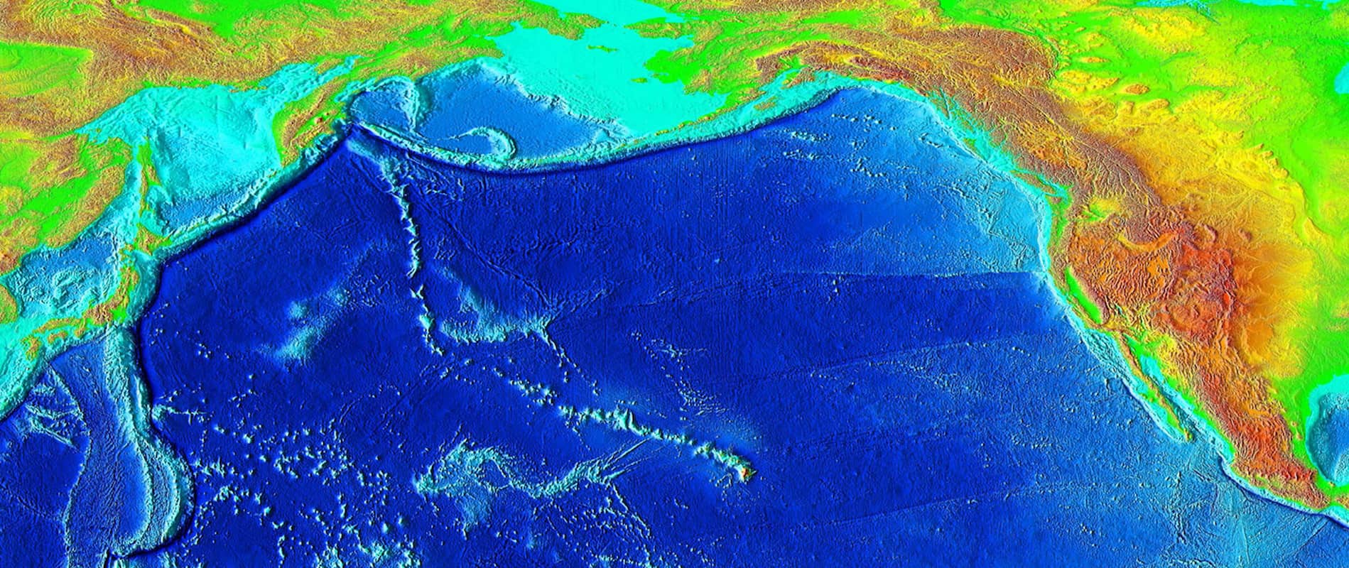
Hawaiian-Emperor seamount chain
Description
A wide view of the Hawaiian Island Emperor Seamounts Chain. The Hawaiian Islands (above water) and Emperor Seamounts (underwater) extend from the middle of the Pacific to Japan. A hotspot under the Pacific Plate created the Hawaiian chain over the course of fifty million years as the tectonic plate moved toward the northwestern direction.
Object ID
51.01.03
Citation (Chicago-style 18th Edition)
National Geophysical Data Center/USGS
.
Hawaiian-Emperor seamount chain
.
2006
.
https://en.wikipedia.org/wiki/Hawaiian%E2%80%93Emperor_seamount_chain#/media/File:Hawaii_hotspot.jpg
.
Multimedia details
Creator
National Geophysical Data Center/USGS
Publisher
National Oceanic and Atmospheric Administration (NOAA)
Date
2006
Type
Image
Format
Photograph
File Format
jpg
Source
Wikimedia
Licensor
Public Domain
MUMI Number
51.01.IMG.003
Creator
National Geophysical Data Center/USGS
Publisher
National Oceanic and Atmospheric Administration (NOAA)
Date
2006
Type
Image
Format
Photograph
File Format
jpg
Source
Wikimedia
Licensor
Public Domain
MUMI Number
51.01.IMG.003
No Known Copyright
The organization that has made the Item available believes that the Item is in the Public Domain under the laws of the United States, but a determination was not made as to its copyright status under the copyright laws of other countries. The Item may not be in the Public Domain under the laws of other countries. Please refer to the organization that has made the Item available for more information.
NOTICES
- Unless expressly stated otherwise, the organization that has made this Item available makes no warranties about the Item and cannot guarantee the accuracy of this Rights Statement. You are responsible for your own use.
- You may find additional information about the copyright status of the Item on the website of the organization that has made the Item available.
- You may need to obtain other permissions for your intended use. For example, other rights such as publicity, privacy or moral rights may limit how you may use the material.
URI for this statement: http://rightsstatements.org/vocab/NoC-US/1.0/