

IMAGE
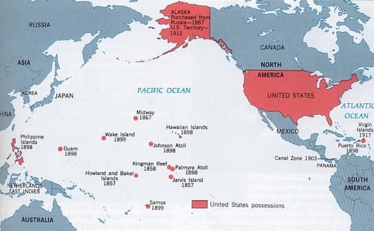
Map of Pacific Rim Countries
Object ID
36.03.01
Citation (Chicago-style 18th Edition)
Multimedia details
Publisher
Foundation for Defense of Democracy
Type
Image
Format
Map
File Format
jpg
Source
Foundation for Defense of Democracy
Licensor
Copyright Unknown
MUMI Number
36.03.IMG.013
Publisher
Foundation for Defense of Democracy
Type
Image
Format
Map
File Format
jpg
Source
Foundation for Defense of Democracy
Licensor
Copyright Unknown
MUMI Number
36.03.IMG.013
Used in reliance on Fair Use
This in-copyright item is presented here in accordance with the authors’ fair use rights. Its use in other contexts may require permission from the copyright holder.