



Search the Media Repository
Discover the curated images, videos, and primary sources featured throughout Foundations and Futures
History is more than just text on a page; it is the photographs, voices, and artifacts of the people who lived it. The images and recordings featured across Foundations and Futures are part of a meticulously curated media repository. Whether you are building a lesson plan or investigating an artifact, you can use this database to trace the provenance of our media: discover who created an asset, the historical context behind it, and how it can be used to bring Asian American and Pacific Islander experiences into your classroom.
Multimedia
Chapters
-
Image
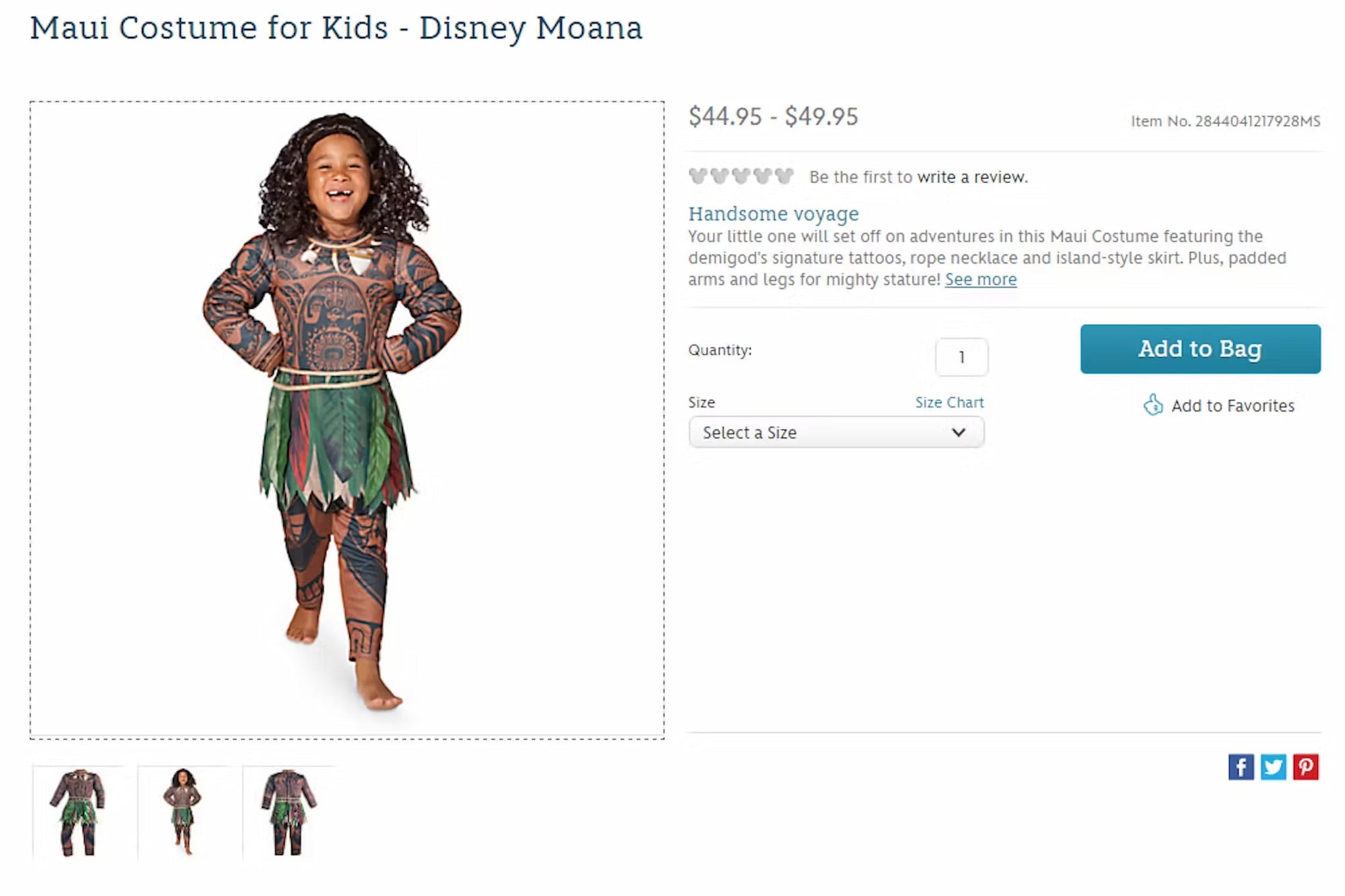
Maui Character Costume
While Disney’s Moana film was successful in the box office, there has been much dialogue surrounding the power and impact of storytelling, distribution, marketing, and profit, like this skin suit costume for sale.
Featured in:
Pacific Islanders, Module 5
-
Text
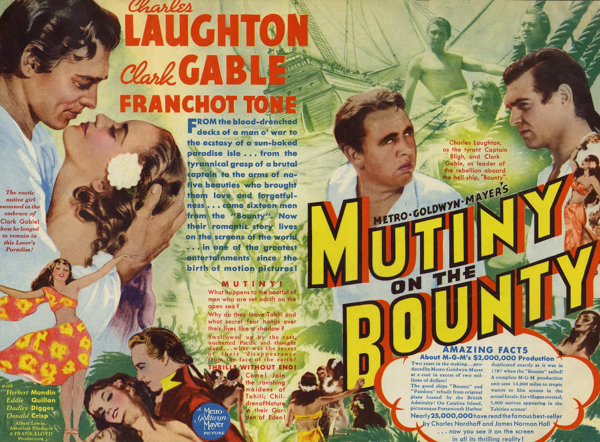
Mutiny on the Bounty Poster
Mutiny on the Bounty has multiple film adaptations centering a story of British royal navy officers in Tahiti in the late 1700s.
Featured in:
Pacific Islanders, Module 5
-
Video
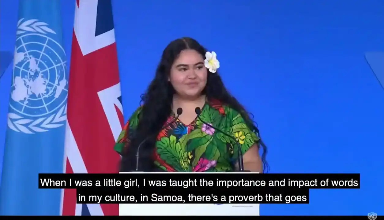
Brianna Fruean’s UN Climate Summit Address
Brianna Fruean from Pacific Climate Warriors (350 Pacific), spoke at the UN Climate Summit in 2021. She shared an important message to world leaders from Pacific youth: “We are not drowning, we are fighting!”
Featured in:
Pacific Islanders, Module 4
-
Video
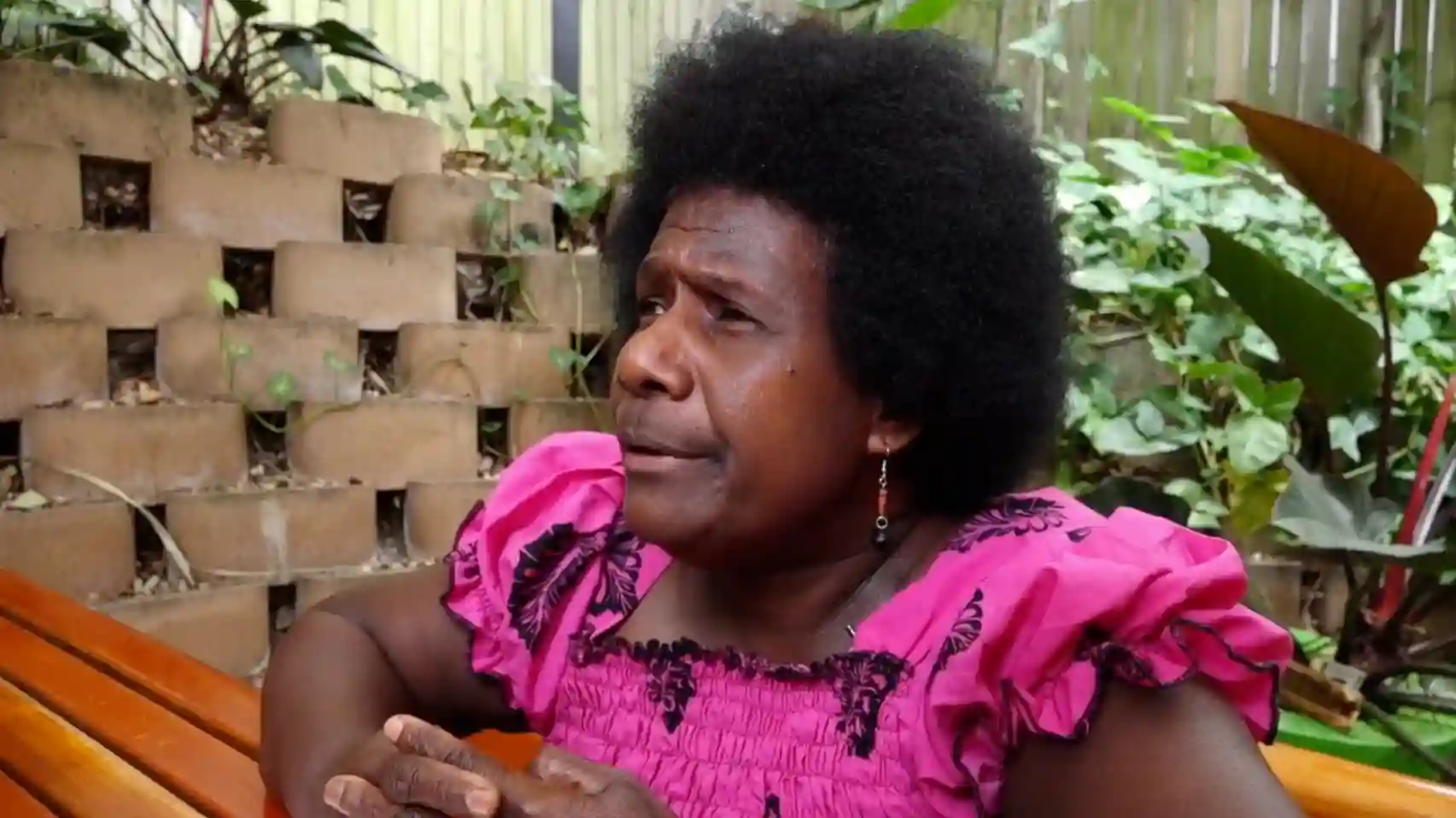
Climate Activist Ursula Rakova
In this clip, Ursula Rakova, a climate activist from Carteret Islands, shares her experiences of the ongoing impacts of climate change on Carteret Islands and its peoples.
Featured in:
Pacific Islanders, Module 4
-
Video
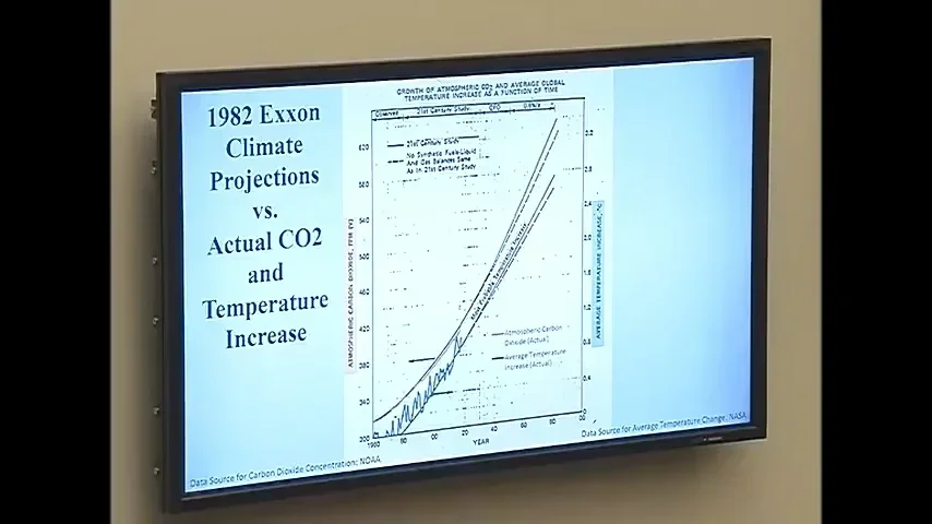
Alexandria Ocasio-Cortez Questions Exxon Scientists
In 2019, scientists who worked at Exxon in the 1980s testified before the US Congress Committee on Oversight & Reform. Here they respond to Congresswoman Alexandria Ocasio-Cortez’s questions regarding Exxon’s knowledge of the impact of burning fossil fuels as early as the 1970s.
Featured in:
Pacific Islanders, Module 4
-
Video
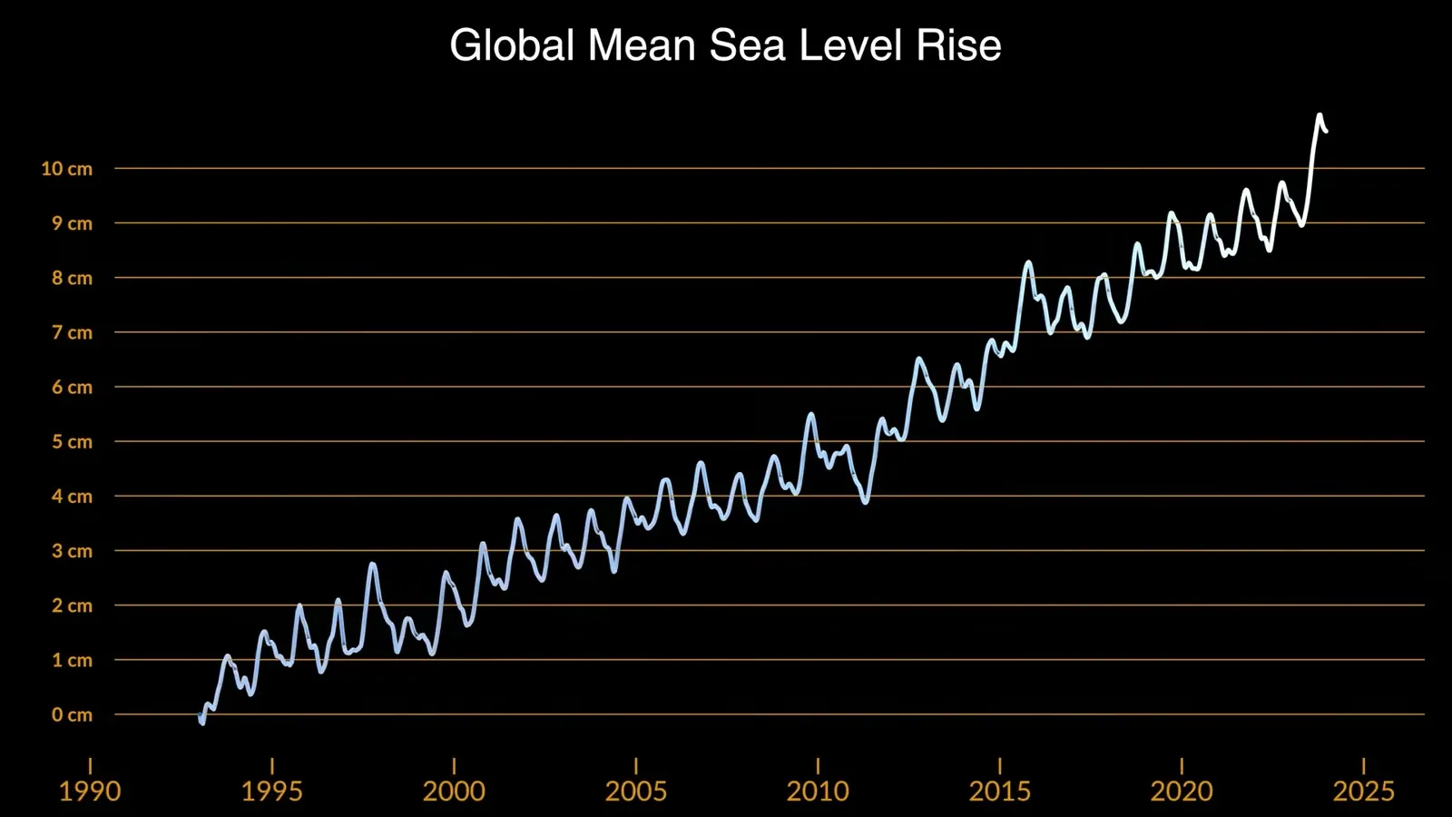
Sea Level Rise Visualization
This 2024 video from NASA Scientific Visualization Studio tracks the average rise in global sea level from 1993-2023. In some places, such as Oceania, local sea levels are rising much faster than the global average.
Featured in:
Pacific Islanders, Module 4
-
Image
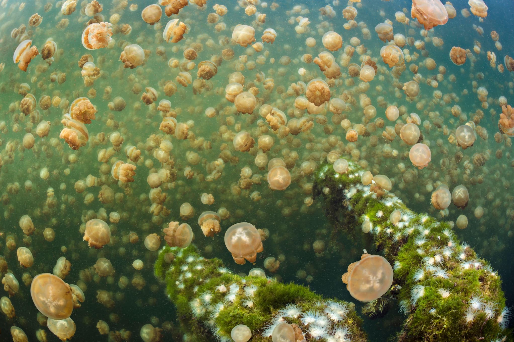
Jellyfish Lake in Palau
Millions of golden jellyfish migrate daily across Ongeim’l Tketau, also known as Jellyfish Lake, a marine lake in Palau.
Featured in:
Pacific Islanders, Module 4
-
Image
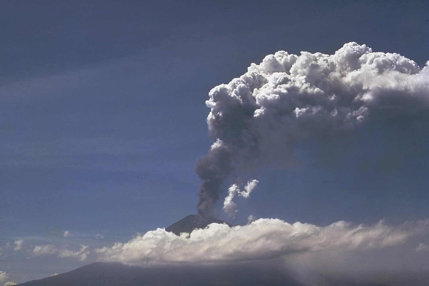
1970 Ulawun Eruption
One third of the world’s volcanic gasses come from the volcanoes of Melanesia. This 1970 photo features an eruption from Ulawun, an active volcano in Papua New Guinea, with its rising ash plume.
Featured in:
Pacific Islanders, Module 4
-
Image
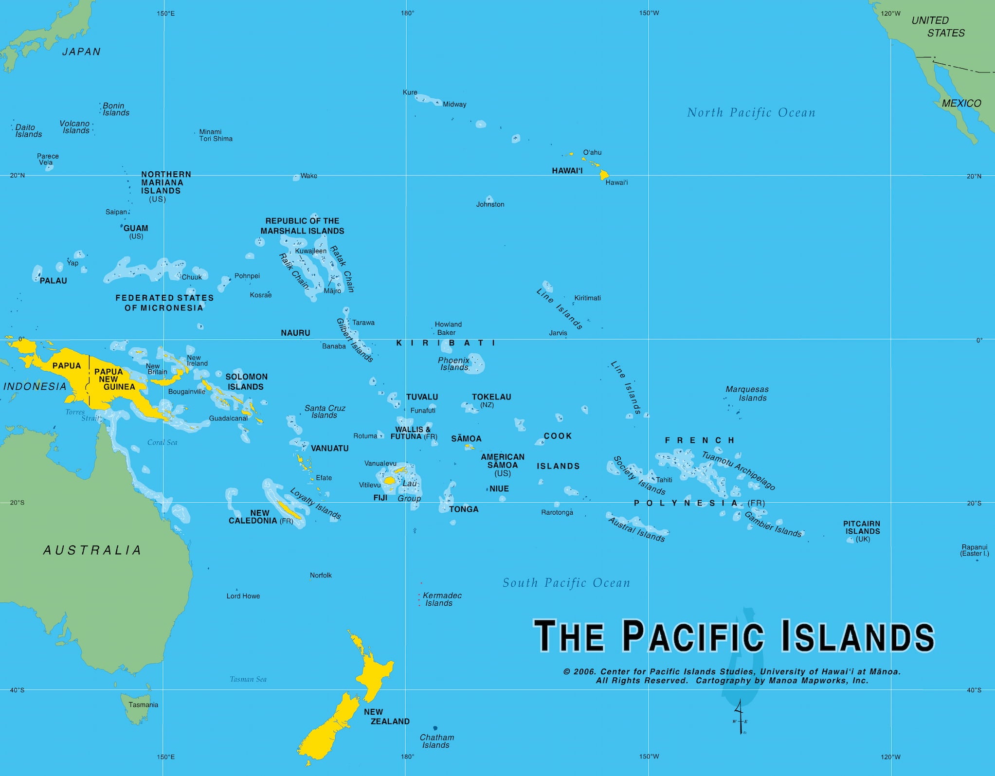
Map of Small and Large Island States
This map from the Center for Pacific Islands Studies, University of Hawaiʻi at Mānoa highlights the land masses of the smaller and larger island states in Oceania. Reproduced with permission.
Featured in:
Pacific Islanders, Module 4
-
Video
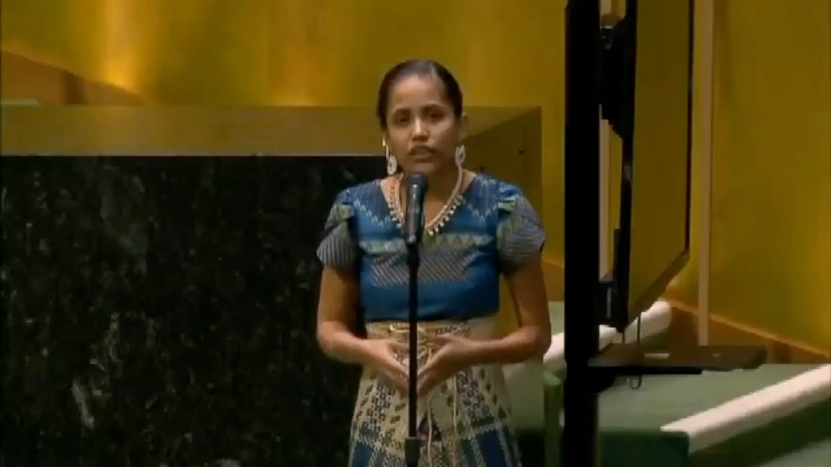
Kathy Jetñil-Kijiner’s UN Address
In this excerpt from poet Kathy Jetñil-Kijiner’s performance at the United Nations, she passionately assures her newborn child, Matafele, that she will resist rising ocean waters and greedy entities polluting the environment, and that their family will not become climate change refugees.
Featured in:
Pacific Islanders, Module 4
-
Text
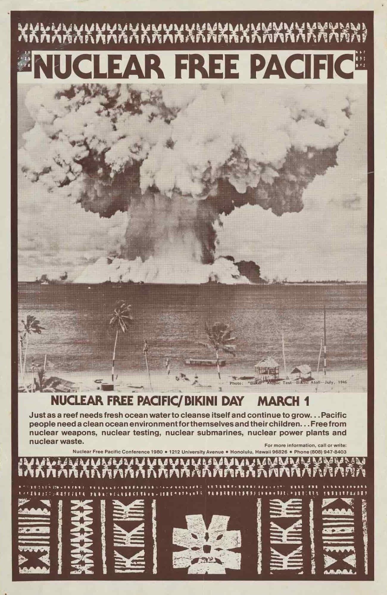
Nuclear Free Pacific Poster
In the aftermath of World War II, the US detonated nuclear devices on Bikini Atoll in the Marshall Islands from 1946-1958, displacing people from their homes. Bikini Atoll remains uninhabitable due to radiation from US nuclear testing.
Featured in:
Pacific Islanders, Module 3
-
Image
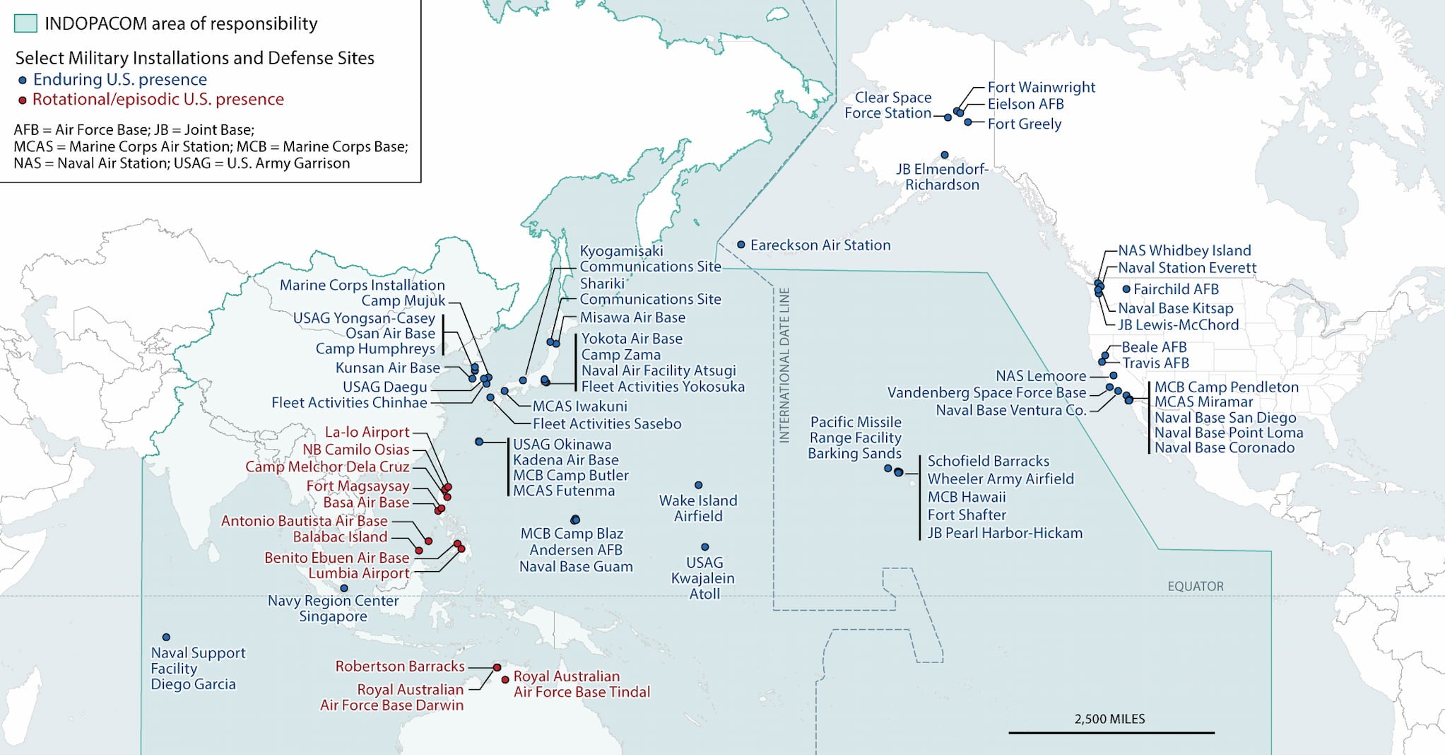
Map of U.S. Military Installations in Pacific
This map from a 2023 US Congress Report identifies select US military installations and defense sites in the Pacific region.
Featured in:
Pacific Islanders, Module 3
-
Image
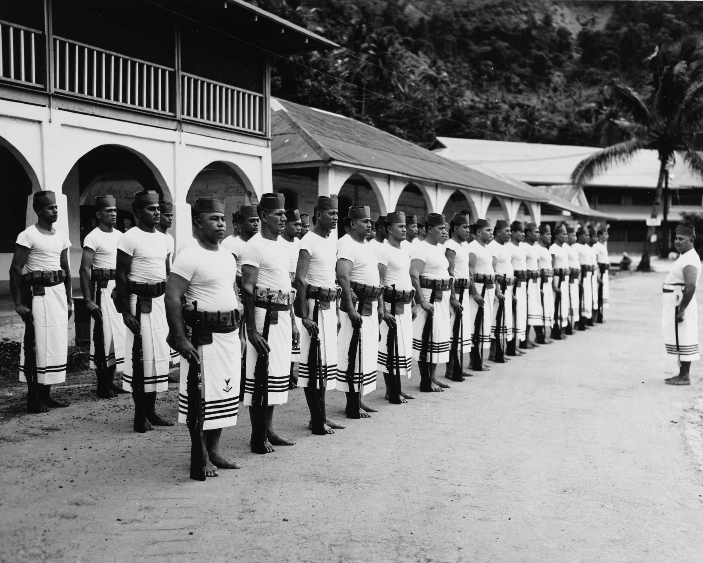
Fitafita Guard
Originally called the Samoan Naval Militia in 1900, the Fitafita Guard served the US Navy on American Sāmoa until 1951.
Featured in:
Pacific Islanders, Module 3
-
Image
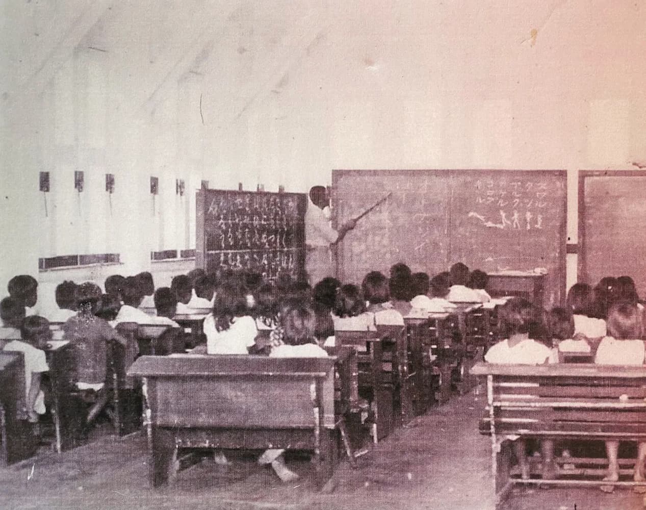
CHamoru Children Attend Japanese School
During World War II, Guåhan (Guam) was occupied by Japanese forces whose war efforts included teaching Japanese culture and language to children. In this image, Japanese characters can be seen written on the chalk boards.
Featured in:
Pacific Islanders, Module 3
-
Image
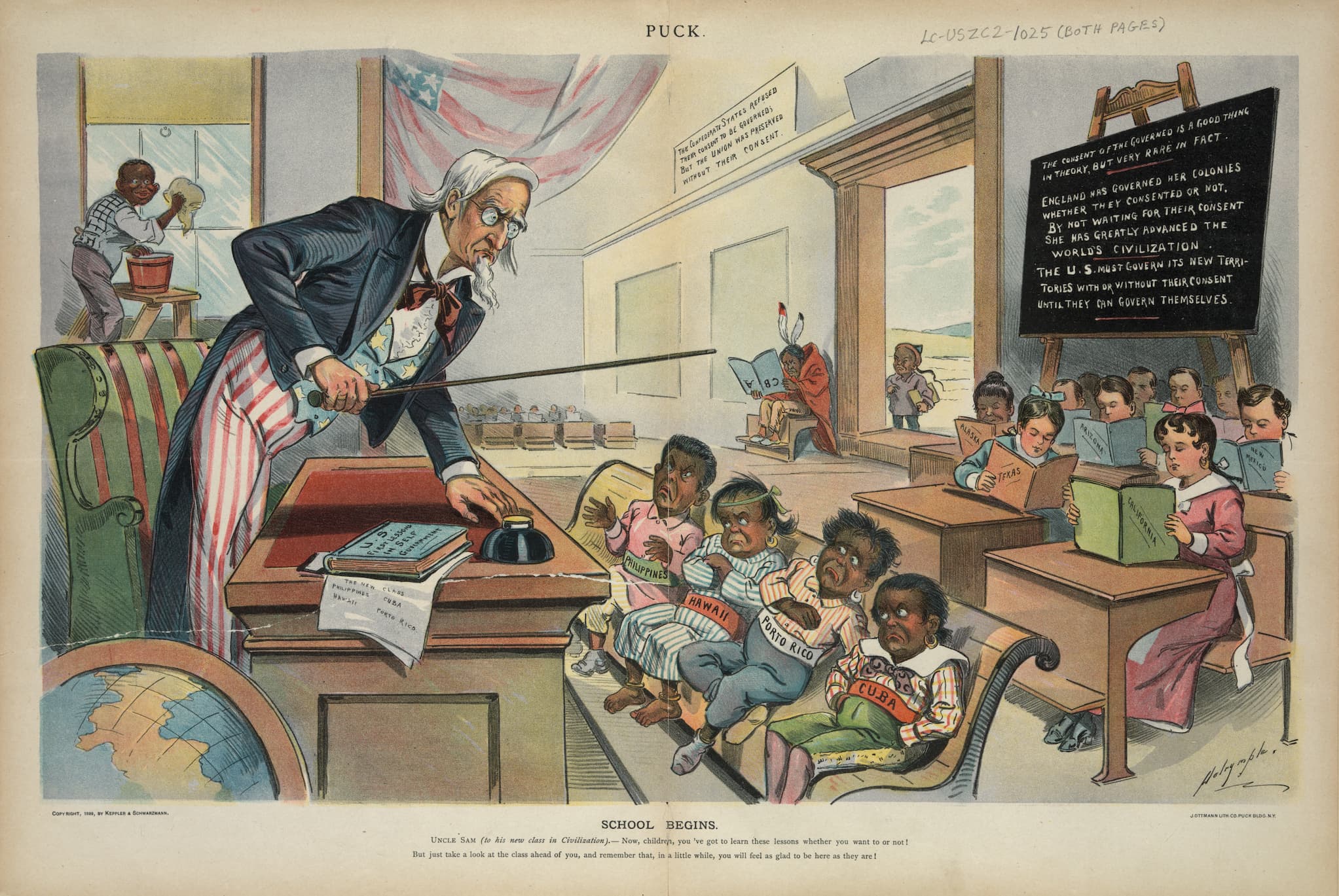
Uncle Sam’s Classroom
In the late nineteenth and early twentieth centuries, US media representations of the Caribbean and the Pacific crudely depicted them as uncivilized children in Uncle Sam’s classroom.
Featured in:
Pacific Islanders, Module 3
-
Image
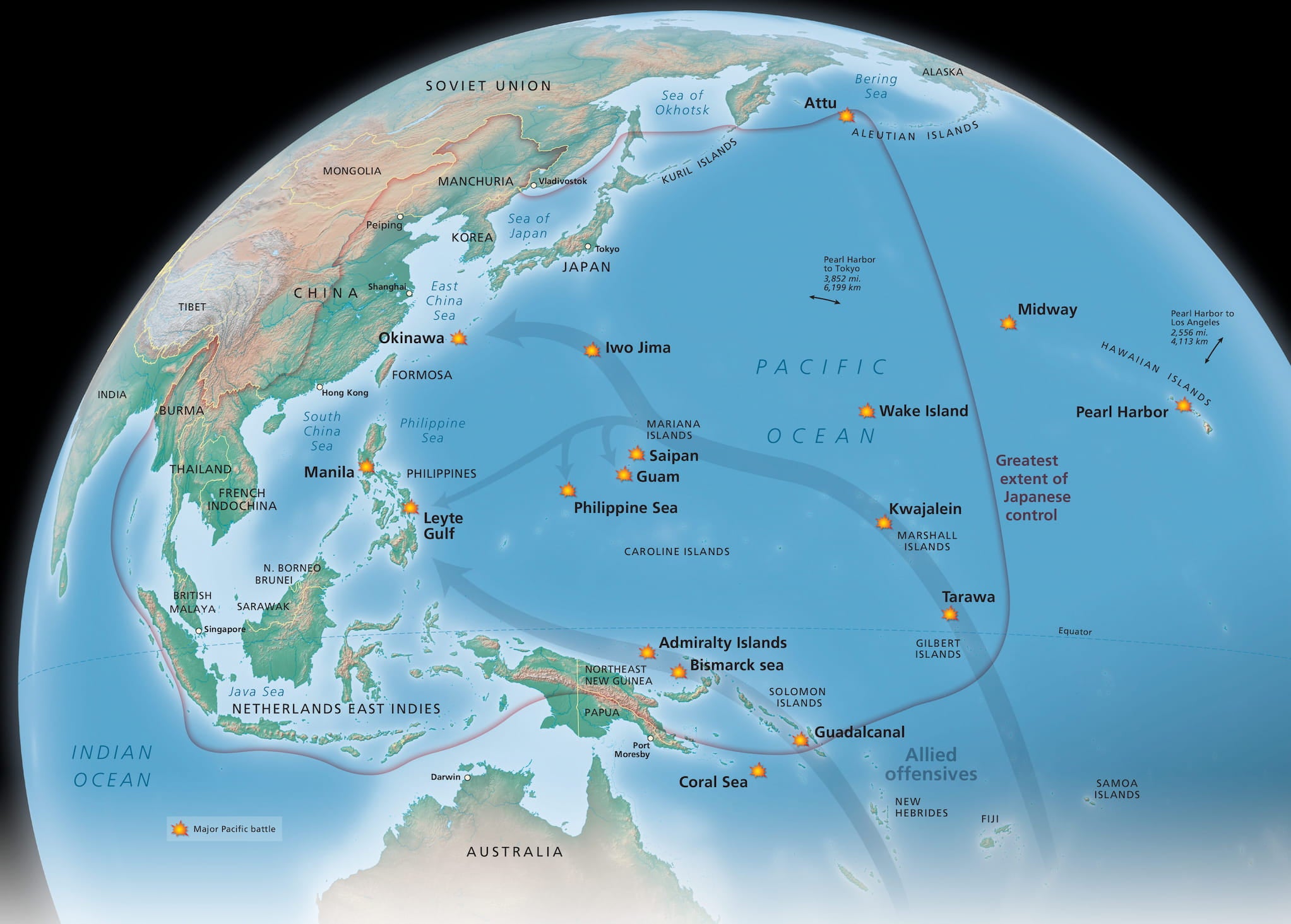
Major Battles of World War II
This map marks the major battles of World War II in the Pacific region with yellow stars. The arrows represent the path of the Allied offensives. The red line identifies the greatest extent of Japan’s control.
Featured in:
Pacific Islanders, Module 3
-
Text
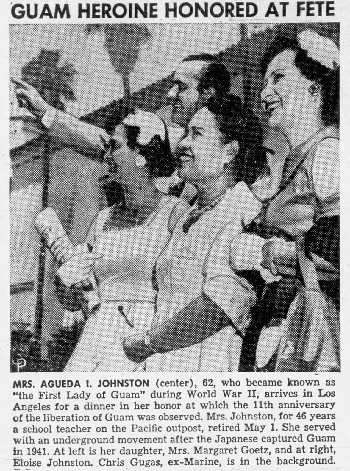
Agueda I. Johnston
Agueda I. Johnston (center), a beacon of hope during World War II, led a secret resistance movement after the Japanese invaded Guåhan (Guam). After Guåhan’s liberation, Johnston continued her service to the community as a lifelong educator and advocate for Guåhan.
Featured in:
Pacific Islanders, Module 3
-
Image
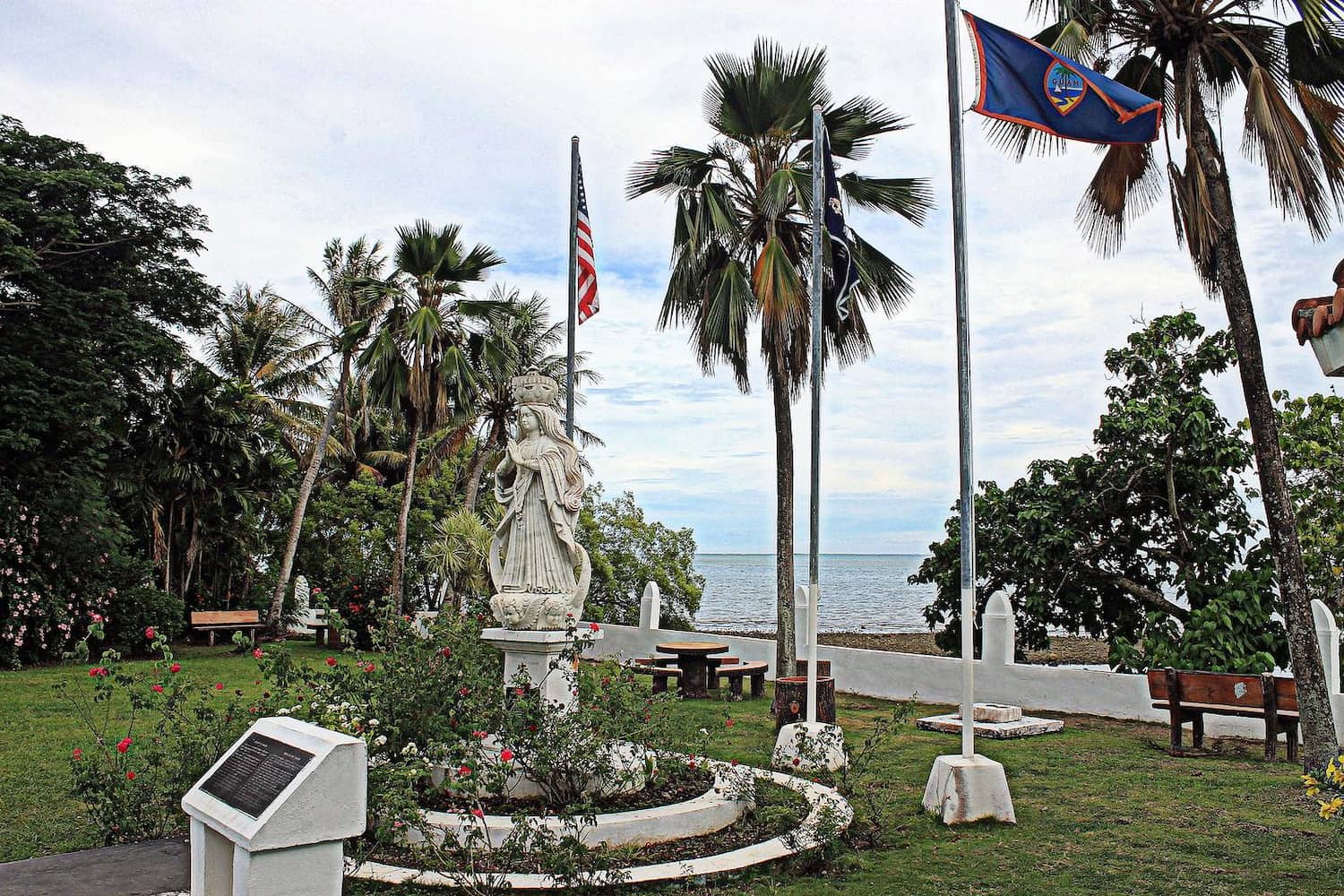
Santa Marian Kamalen
A marble statue of Santa Marian Kamalen, the patron saint of Guåhan (Guam), stands in a park in Malesso’, the southernmost village in Guåhan. The patron saint is most iconically represented by a revered three-hundred-year-old wooden statue housed in the Dulce Nombre de Maria Cathedral-Basilica in Hagåtña.
Featured in:
Pacific Islanders, Module 3
-
Image
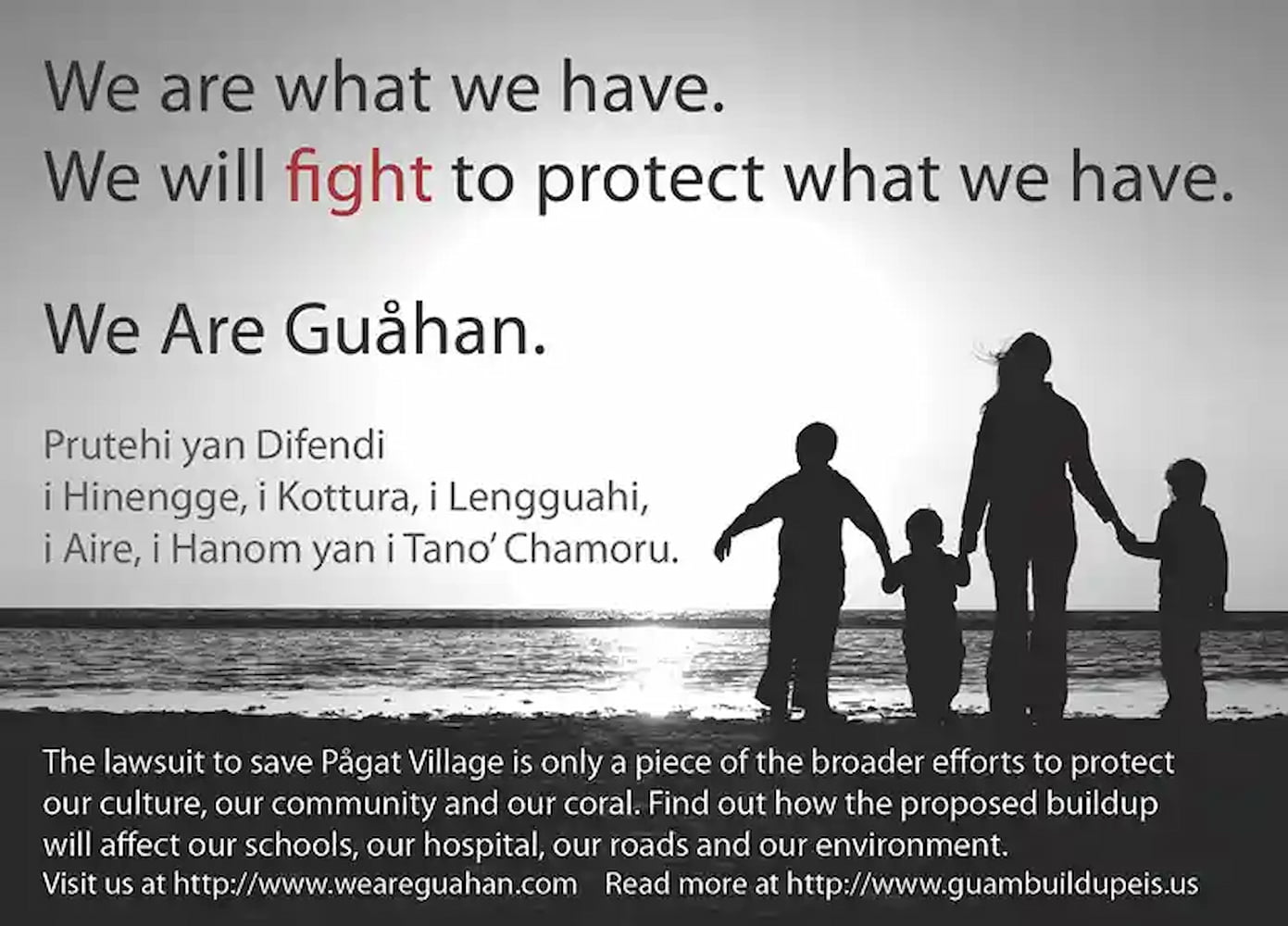
We Are Guåhan
Since 2010, We Are Guåhan has advocated for the protection and preservation of Pågat in Guåhan by actively working to prevent military use of the site and to raise awareness about its cultural and environmental significance.
Featured in:
Pacific Islanders, Module 2
-
Image
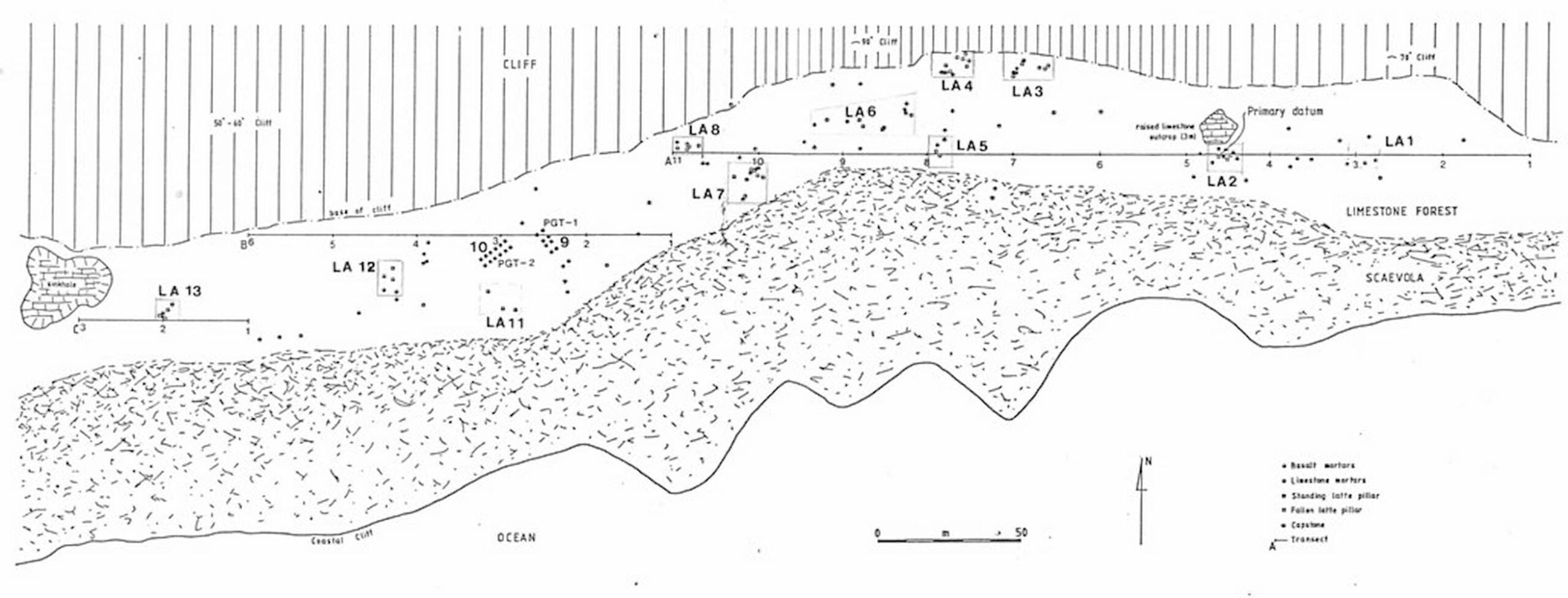
Pågat Archaeological Site Plan
Archaeological site plan of Pågat in Guåhan. The numerous markers in the map identify remains of the ancient CHamoru village and burial site, proof of a thriving Indigenous culture long before Spanish colonial control.
Featured in:
Pacific Islanders, Module 2