

IMAGE
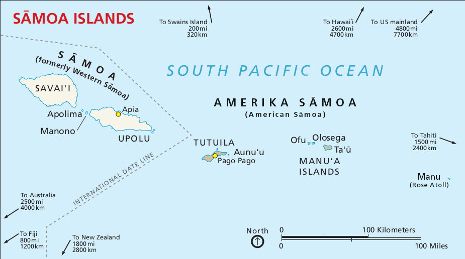
Map of Sāmoa Islands
Object ID
24.01.02
Citation (Chicago-style 18th Edition)
Foundations and Futures
.
Map of Sāmoa Islands
.
2025
.
Multimedia details
Creator
Foundations and Futures
Publisher
University of California Los Angeles Asian American Studies Center
Date
2025
Type
Image
Format
Map
File Format
png
Source
Foundations and Futures
Licensor
Foundations and Futures
MUMI Number
24.01.GFX.02
Creator
Foundations and Futures
Publisher
University of California Los Angeles Asian American Studies Center
Date
2025
Type
Image
Format
Map
File Format
png
Source
Foundations and Futures
Licensor
Foundations and Futures
MUMI Number
24.01.GFX.02
In Copyright
This Item is protected by copyright and/or related rights. You are free to use this Item in any way that is permitted by the copyright and related rights legislation that applies to your use. For other uses you need to obtain permission from the rights-holder(s).
NOTICES
- Unless expressly stated otherwise, the organization that has made this Item available makes no warranties about the Item and cannot guarantee the accuracy of this Rights Statement. You are responsible for your own use.
- You may find additional information about the copyright status of the Item on the website of the organization that has made the Item available.
- You may need to obtain other permissions for your intended use. For example, other rights such as publicity, privacy or moral rights may limit how you may use the material.
URI for this statement: http://rightsstatements.org/vocab/InC/1.0/