


Micronesian leaders and U.S. Secretary of State stand for group photo behind press conference table. Flags from each respective country hang behind.
Module 3: Geopolitics of the Pacific Islands
Is there still a need to fight for decolonization in the Pacific today?
The children thought it was snow. But what they held in their hands was anything but beautiful; what they held would creep into their DNA and sicken their people. What they held in their hands were ashes of death because it was nuclear fallout. From 1946 to 1958, the US held sixty-seven nuclear weapons tests in the Marshall Islands. In 1946, the Navy told the people of Bikini Atoll that these tests were for the good of mankind.
From cancer to “jellyfish babies” born with no bones and transparent skin, this period of nuclear testing would be devastating to the Marshallese people, their health, and their environment. For the US, this testing in the Marshall Islands was justified in the name of national security. They believed the islands were a perfect place to experiment with nuclear weapons.
Referring to whether or not the US should forcefully take land from the Marshallese for military purposes, instead of buying the land, US Secretary of State at the time Henry Kissinger said, “There are only 90,000 people out there, who gives a damn?” 1 This quote highlights the vast difference in perspective between those who live in the islands and those who view the islands as a place to control.
Unfortunately, it is not just the US that views the Pacific Islands this way. Both the United Kingdom and France also tested nuclear weapons in the Pacific Islands, Kiritimati and Moruroa, respectively.
Understanding why the Pacific Islands have been and continue to be used and viewed in this way is the core objective of this module. In this module, we will explore what geopolitics means and how it affects the islands. We will also examine the role that military strategy plays in imperialism in the Pacific Islands, and how Pacific Islanders are exercising agency among geopolitical maneuvering today.
What is geopolitics and how does it affect the Pacific Islands?
What role does military strategy play in imperialism in the Pacific Islands?
How do Pacific Islanders exercise agency in the context of global geopolitics?
Geopolitics and Islands
At its core, geopolitics analyzes how geography affects politics and international relations. It uses geographical frames to make sense of the world. Those who study geopolitics are concerned with topics such as geographical location, resources, land and sea power, among others.
To understand how large powers think about islands, we must think about geopolitics. The dominant imagination of islands is that they are small and isolated. People look at maps of the Pacific and see tiny dots scattered in an ocean of blue. They see islands as specks of land destined to be dependent on the larger landmasses around them. They see islands as “over there” and, in many ways, disconnected from the rest of the world.
Because of this, these isolated and “small” land masses are also places where one can experiment with little political resistance or headache. Scholars call this the “laboratory rationale” for studying the islands. Islands are places to experiment scientifically, politically, environmentally, and socially. The fact that the Pacific Islands are small and isolated means that larger powers can do what they want with the expectation that those living on the islands will simply suffer, as demonstrated by what the US did to the Marshall Islands.
For the US, islands figured prominently in military strategy, especially when looking at the work of the prominent American naval strategist, Alfred Thayer Mahan. Former President of the Naval War College, Mahan developed the concept of “sea power,” arguing that a world power needed overseas access to materials and markets to cement its global status. Islands could be utilized as part of a great power’s sea power toolbox.
Mahan argued that if the US wished to join the scramble for the world’s wealth, it would have to build warships and dispatch them to take control of distant islands, ports, peninsulas, and strongholds where a navy can be protected and refurbished. He argued that permanent naval bases and coaling stations were essential to safeguarding the prosperity and national security of the US.
This was all occurring in an age of growing US imperialism. Imperialism refers to the process by which a country extends its power or control over other peoples or countries, often involving the use of militaries. The result is that the imperial power controls other communities.
With the use of the US military for example, we see this in the subregion of the Pacific Islands known as Micronesia, particularly Guåhan, the Commonwealth of the Northern Mariana Islands, the Republic of Palau, the Republic of the Marshall Islands, and the Federated States of Micronesia.
Guåhan, Colonialism, and US Military Strategy
As discussed in the last module, Guåhan (Guam) is an unincorporated territory of the US. One of the primary reasons it remains a US territory today is because of its strategic location. Guåhan is the largest island between Hawaiʻi and the Philippines with a major harbor, and it is the largest island between Japan and Papua New Guinea with the capability for hosting major runways. This makes Guåhan a useful island to control if the US wants to project power into the Pacific.
As some have said of the island, “Guam represents the US military’s most important logistics and support base in the Indo-Pacific region… Guam would be the gas station, repair shop, and command center for US naval and air forces during a confrontation.” 2 Thus, we can see how location becomes the geopolitical rationale for holding on to Guåhan.
To maintain this position, the US has engaged in a process of militarization on the island, preparing indefinitely for war. This perpetual preparation for war can manifest itself physically and environmentally, but also socially, culturally, and symbolically. The biggest manifestation of militarization in Guåhan is that roughly 27 percent of the island is occupied by the US military. Guåhan is only 212 square miles with roughly 160,000 people.
The smallest state, Rhode Island, is almost five times larger than Guåhan, and the least populated state, Wyoming, has three times the population of the island. Despite its geographically small land size, the US military controls around fifty thousand acres. That is nearly 38,000 football fields, a substantial amount of land! In Guåhan, there is an Air Force Base and a Naval Base, as well as the first Marine Corps Base to be activated since 1952.
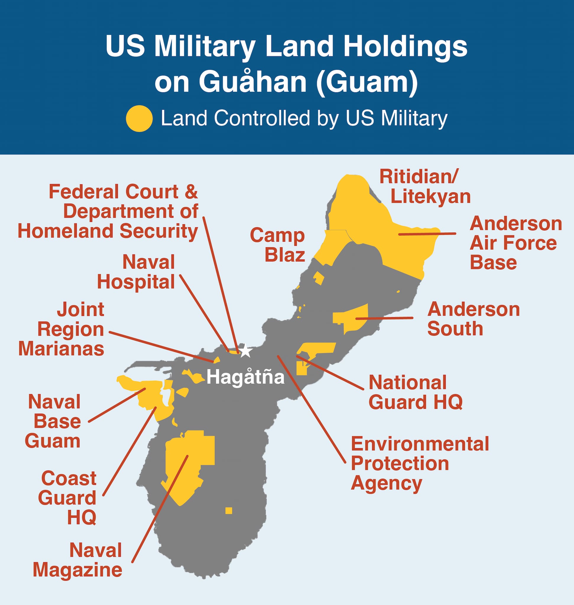
Image 20.03.02 — This map shows the US military’s land holdings in the island of Guåhan (Guam). Roughly 27 percent of the island has bases or other installations that are controlled by the US military. These land holdings are found throughout the island.
The militarization of Guåhan and the island’s status as an unincorporated territory go hand-in-hand. The fact that the island is technically “US soil” means that the US military can largely do what it wants in Guåhan without having to ask permission. In sovereign countries, the US (even if it is incredibly powerful) still needs to seek agreement from the “host-nation,” as they do in countries with US military bases like South Korea or Germany. This can create political pressure or headache.
In Guåhan, this pressure and headache are heavily reduced. Guåhan is an island far away from the US; it has a relatively small population, and is not a state (which would have voting representation in the federal government). Military leaders expressed this too. For example, Major General Dennis Larsen said, “This is American soil in the midst of the Pacific. Guam is a US territory. We can do what we want here and make huge investments without fear of being thrown out.” 3
Ultimately, looking at Guåhan shows how US military strategy and geopolitics intersect with US colonialism in the Pacific Islands.
However, just as we discussed in the last module, the CHamorus of Guåhan do not just accept militarization. There have been governmental initiatives, social movements, and grassroots activism efforts to oppose the overreach of the military in Guåhan. For example, amidst the proposal to move more US troops from Okinawa to Guåhan to be trained and stationed, groups like Prutehi Litekyan were created to fight for the environment and protect Indigenous sacred places that are under threat by continuing US military expansion in the island.
Trust Territory of the Pacific Islands
Beyond Guåhan (Guam), the US also secures its geopolitical interests via the Commonwealth of the Northern Mariana Islands (CNMI), the Republic of Palau, the Republic of the Marshall Islands, and the Federated States of Micronesia. All of these islands once belonged to the Trust Territory of the Pacific Islands (TTPI).
During World War II, these islands were occupied by the Japanese, and many were the sites of bloody battles. After the war, these Japanese-controlled islands were transferred under the supervision of the newly created United Nations as part of a trusteeship system. The trusteeship system was meant to be a temporary status, and these territories were meant to develop towards self-government or independence.
The US advocated to oversee these former Japanese islands in the Pacific, and the Trust Territory of the Pacific Islands was established. Historian Hal Friedman writes, “The Pacific represents the only region of the world where the US deviated from its wartime political pledge not to obtain direct physical control over foreign territory.” 4 Even if it was under the TTPI, the US effectively controlled these islands. The rationale for acquisition of these islands was largely geopolitical.
After World War II, American military strategists became even more convinced that a key component to American security in East Asia was turning the Pacific Basin into an “American Lake,” which inevitably meant American control of strategically located Micronesia. As the Joint Chiefs of Staff at the time said, the Pacific and East Asia were “inseparable” for planning purposes. Control of Micronesia was to play its role in the military’s move to have mobile forces and island bases in the region. The islands would help constitute a base network from which offensive operations could be launched.
In addition, military planners argued that bases for mobile forces was not the only reason to control these island chains. Rather, these islands were to be controlled, even if they were not to be developed into bases, simply so that they can be “denied” to others. This is referred to as “strategic denial,” in which the US becomes responsible for these islands’ defense and also reserves the right to deny other countries access to or use of the land, airspace, or territorial seas of the islands. In other words, the US controlled these islands so that nobody else could. They saw potential control of the islands by another power as threatening, and they wanted to ensure that this would never happen.
The TTPI would eventually come to an end. The Pacific Islanders did not want to live in political limbo forever, and they fought for a different political status. They formed the Congress of Micronesia and various Political Status Commissions to investigate a different future for the islands.
This resulted in two political statuses. First, the Northern Mariana Islands entered into a Commonwealth agreement with the US, which legally claimed the islands as US soil and its people as US citizens. Second, the remaining islands formed the independent countries of the Republic of Palau, the Republic of the Marshall Islands, and the Federated States of Micronesia, which all entered into free association with the US. Despite these changes in political status, the US is still in control of the islands’ defense and maintains their tactic of strategic denial.
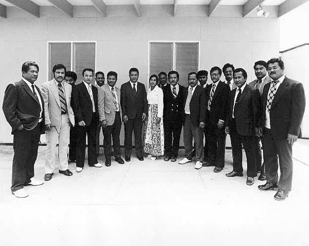
Image 20.03.04 — Members of the House in the Congress of Micronesia, which formed as Pacific Islanders pushed to end US control and determine their political futures.
In the islands that became freely associated with the US, strategic denial came in the form of the Compacts of Free Association (COFA), signed agreements that outlined the relationship between the two countries. The agreements include, but are not limited to, economic packages, defense agreements, and other stipulations.
To date, the Republic of Palau, the Republic of the Marshall Islands, and the Federated States of Micronesia all have separate COFA agreements with the US. Therefore, in each of the former TTPI islands, the US has been able to establish military installations and facilities, as shown, for example, by its activities on Kwajalein Atoll in the Marshall Islands. The US has also been planning new installations in Palau and the state of Yap in the Federated States of Micronesia.
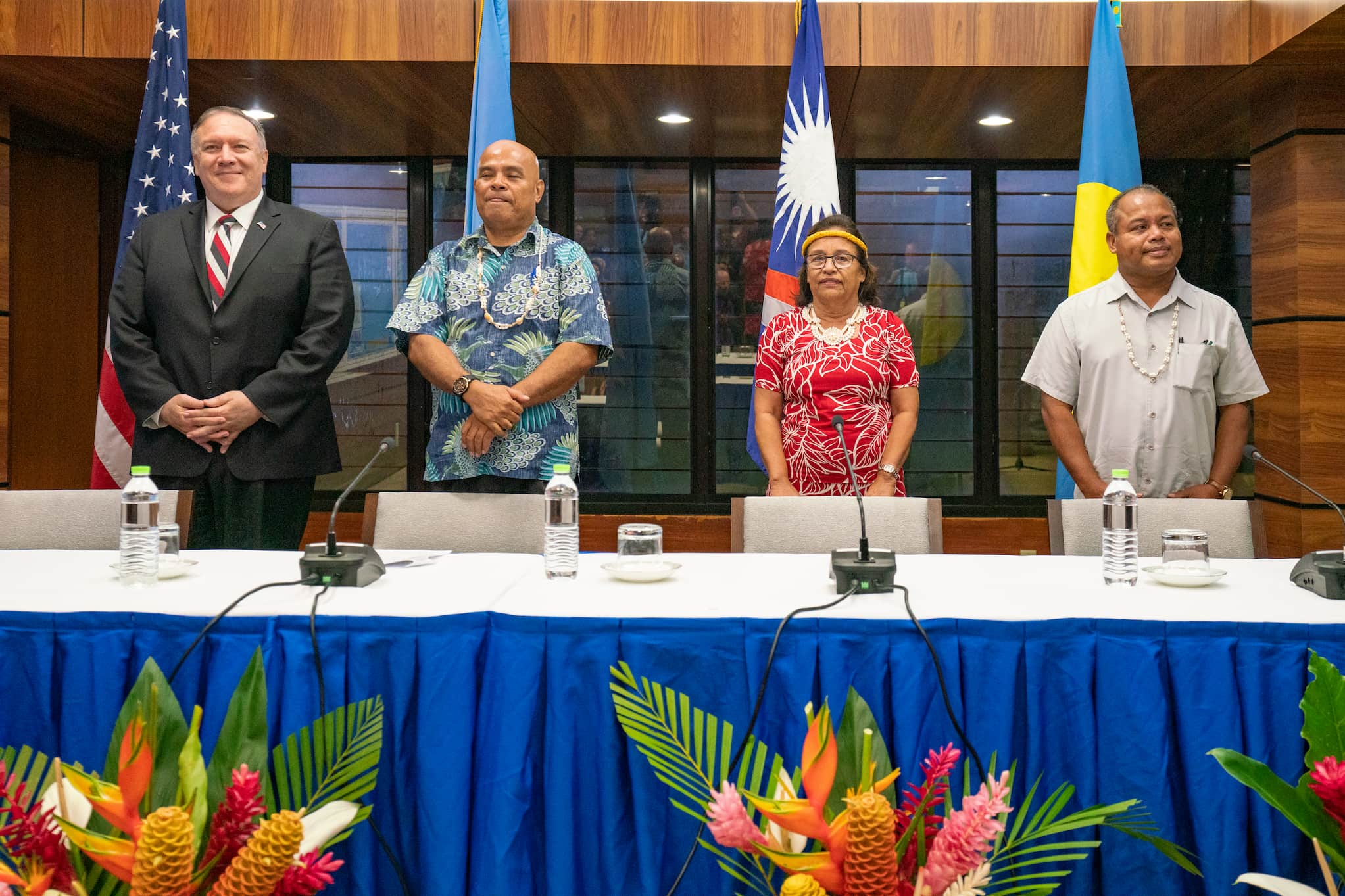
Image 20.03.05 — An August 2019 meeting with Micronesian leaders and the US. Left to Right: US Secretary of State Mike Pompeo, Federated States of Micronesia President David Panuelo, Marshall Islands President Hilda Heine, and Palau Vice President Raynold Oilouch.
Guåhan and the TTPI examples show how geopolitics, islands, and the US military are all entangled. Micronesia was turned into an area of the world the US controlled to keep others out in the name of national security. This reality can be traced back to the geopolitical imagination of islands and how large powers viewed how they can use these islands. This has made the relationship between Micronesians and the US military more layered and complex.
On one hand, there are often economic benefits to military presence. But, on the other hand, this comes at an environmental, cultural, and political cost. Every day, Micronesians try to navigate this complexity by exercising their agency. In the next module, we will delve further into self-determination, sovereignty, and decolonization—all concepts related to the exercise of agency.
Glossary terms in this module
colonialism Where it’s used
The process in which one country or people controls another place or people through partial or full political control for an extended period. Colonialism has lasting economic, social, and cultural effects even after the period of formal colonization is over.
free association Where it’s used
A political status in which a sovereign country establishes a special relationship with another country, usually a previous colonial power. This agreement between two countries includes, but is not limited to, economic packages and defense agreements. The Republic of Palau, the Republic of the Marshall Islands, and the Federated States of Micronesia all have separate agreements with the US, known as Compacts of Free Association (COFA).
geopolitics Where it’s used
The changing political and international relations that are tied to a place’s geography.
imperialism Where it’s used
The process in which a country extends its power or control over other peoples or countries, often involving the use of militaries.
militarization Where it’s used
The process in which a country orders an increase in military presence to organize and prepare for war.
self-determination Where it’s used
The right of a people to freely determine their political status and freely pursue their economic, social, and cultural development without external interference. This right is recognized by the United Nations and is an important aspect of human rights.
sovereignty Where it’s used
The ability of a country to have independent freedom of action, such as making its own laws and rules without external interference. For Indigenous peoples, sovereignty means having control of their lands and way of life, free from colonial control.
Trust Territory of the Pacific Islands (TTPI) Where it’s used
A group of islands formerly controlled by Japan, which include the Commonwealth of the Northern Mariana Islands, the Republic of Palau, the Republic of the Marshall Islands, and the Federated States of Micronesia. After World War II, the United Nations transferred control of these islands to the United States. The system was meant to be temporary, and these territories were meant to develop towards self-government or independence. However, the US has continued its influence over these islands through free association agreements.
unincorporated territory Where it’s used
A political status in which a territory is owned by a colonizing power and there is no promise of formally joining that power or becoming a state. In the US, people from unincorporated territories such as Guåhan (Guam) and Puerto Rico can not fully participate in American democracy even though they are US citizens.