


Search the Media Repository
Discover the curated images, videos, and primary sources featured throughout Foundations and Futures
History is more than just text on a page; it is the photographs, voices, and artifacts of the people who lived it. The images and recordings featured across Foundations and Futures are part of a meticulously curated media repository. Whether you are building a lesson plan or investigating an artifact, you can use this database to trace the provenance of our media: discover who created an asset, the historical context behind it, and how it can be used to bring Asian American and Pacific Islander experiences into your classroom.
Multimedia
Chapters
-
Image
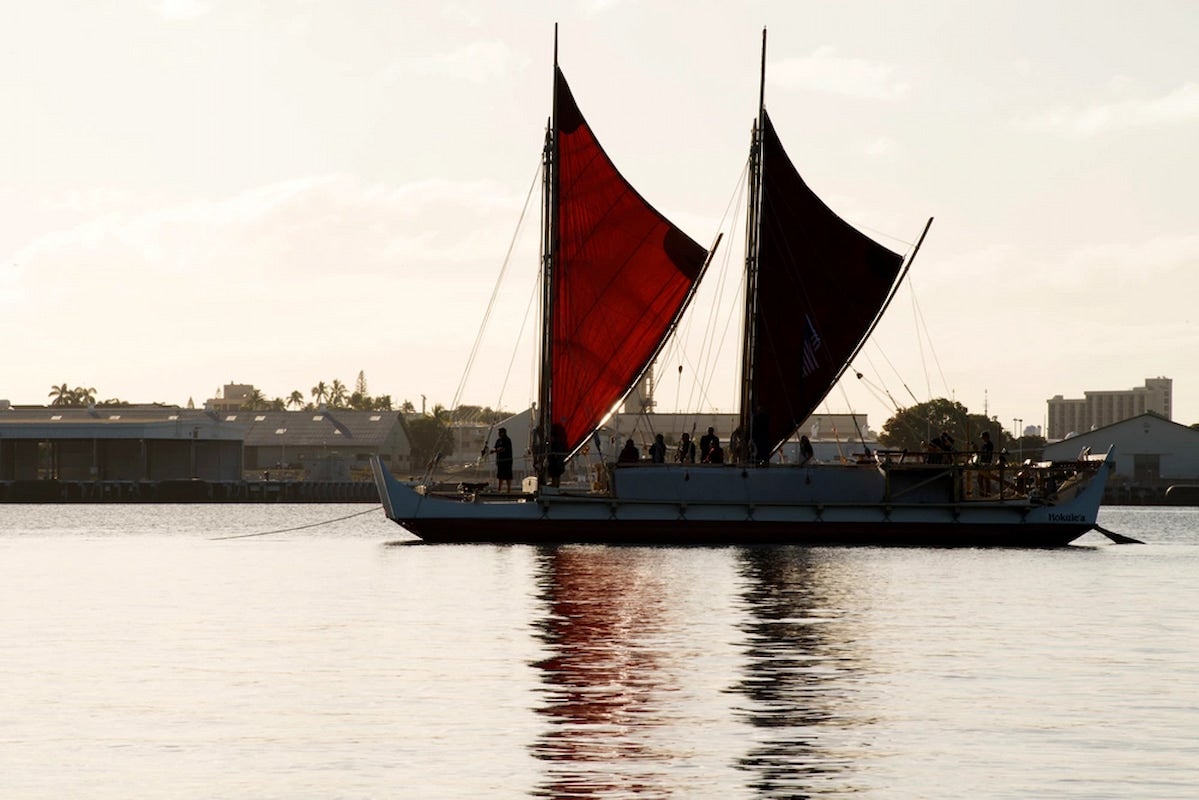
Hōkūleʻa at Puʻuloa
This image features Hōkūleʻa. Its first voyage was meant not only to revitalize navigation in the Pacific, but to show that we can continue to learn from our traditional knowledge and bring it into our everyday lives.
Featured in:
Decolonization in the Pacific, Module 5
-
Video
CHamoru Heads Up
In this video, produced by the CHamoru production company, Nihi Indigenous Media, pairs are shown using Fino’ CHamoru to guess a particular word. It shows how language revitalization can be fun while helping people reconnect with their culture.
Featured in:
Decolonization in the Pacific, Module 5
-
Image
Community Clean Up at Sacred Site
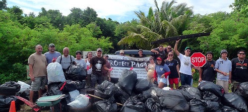
This photo shows a cleanup led by the organization, We Are Guåhan. The community gathered together to pick up hundreds of pounds of trash at the sacred site of Pagat, home to an ancestral CHamoru village in Guam.
Featured in:
Decolonization in the Pacific, Module 5
-
Image
Free West Papua
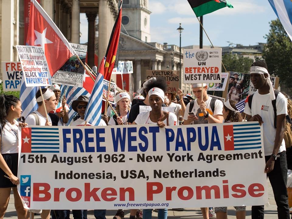
Protestors march for West Papua’s right to self-determination, raising the Morning Star flag as a symbol of independence. Flying this flag is considered illegal by Indonesian authorities and can result in arrest by the military.
Featured in:
Decolonization in the Pacific, Module 4
-
Image
Map of Non-Self Governing Territories
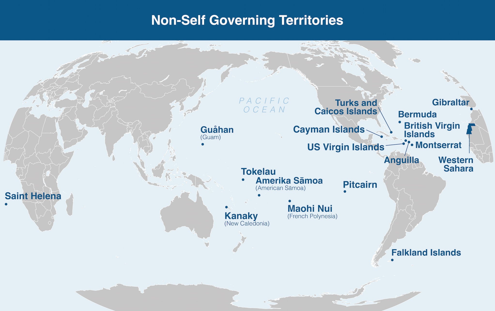
This map shows the Non-Self-Governing Territories (NSGTs) that have not yet achieved full self-government. There are currently six places in the Pacific that are on this map: 1) Guam, 2) American Sāmoa, 3) French Polynesia, 4) New Caledonia, 5) Pitcairn, and 6) Tokelau.
Featured in:
Decolonization in the Pacific, Module 4
-
Video
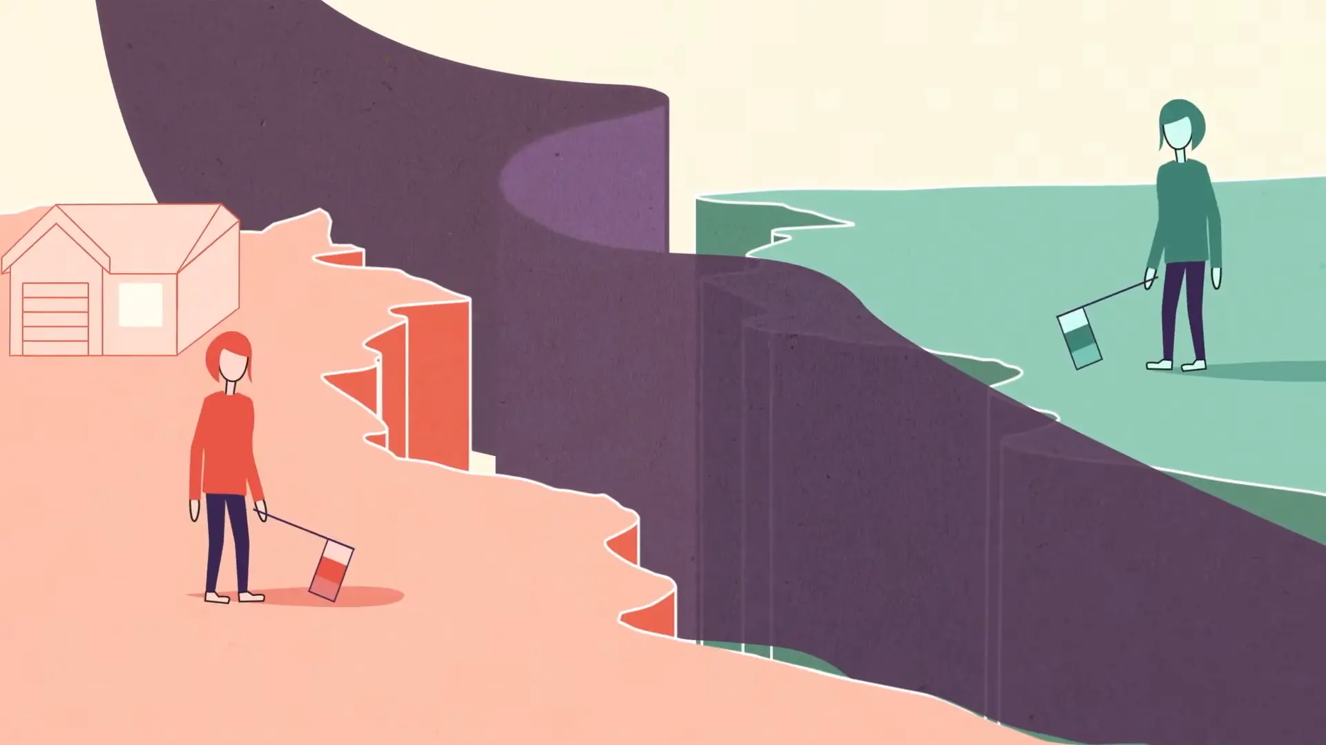
Sovereignty Explained
This video explains what sovereignty is and how the concept applies in the world today. After watching this video, describe sovereignty to a peer. What does it mean to be sovereign?
Featured in:
Decolonization in the Pacific, Module 4
-
Image
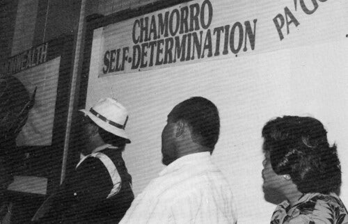
Right to Self-Determination
This 1980s photo shows an educational campaign hosted by Guam-based organization OPI-R, which sought to inform CHamorus of their right to self-determination.
Featured in:
Decolonization in the Pacific, Module 4
-
Image
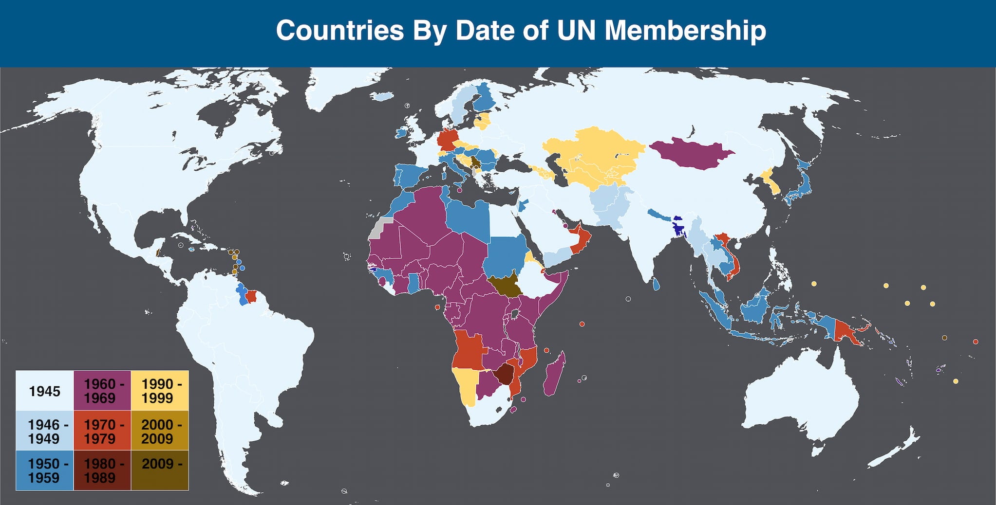
Countries By Date of UN Membership
This map shows when countries joined the United Nations. A major wave of new member states between the 1940s and 1980s reflects an era of global political decolonization, as former colonies gained independence and international recognition.
Featured in:
Decolonization in the Pacific, Module 4
-
Image
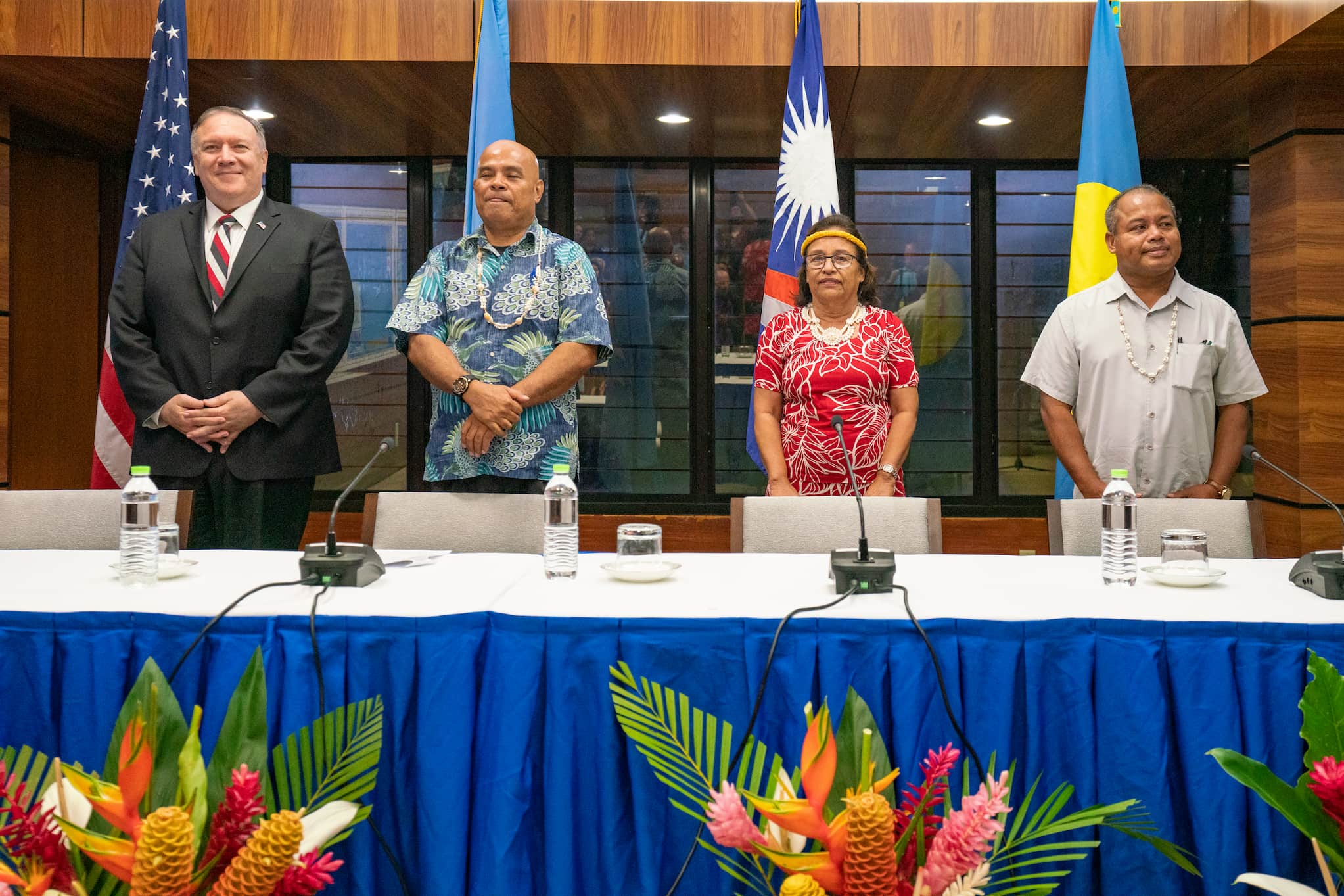
U.S. Secretary of State Meets with Micronesian Leaders
An August 2019 meeting with Micronesian leaders and the US. Left to Right: US Secretary of State Mike Pompeo, Federated States of Micronesia President David Panuelo, Marshall Islands President Hilda Heine, and Palau Vice President Raynold Oilouch.
Featured in:
Decolonization in the Pacific, Module 3
-
Image
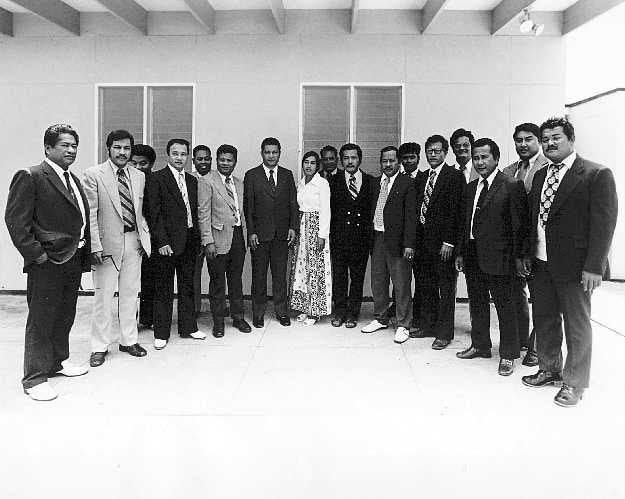
Congress of the Federated States of Micronesia
Members of the House in the Congress of Micronesia, which formed as Pacific Islanders pushed to end US control and determine their political futures.
Featured in:
Decolonization in the Pacific, Module 3
-
Video
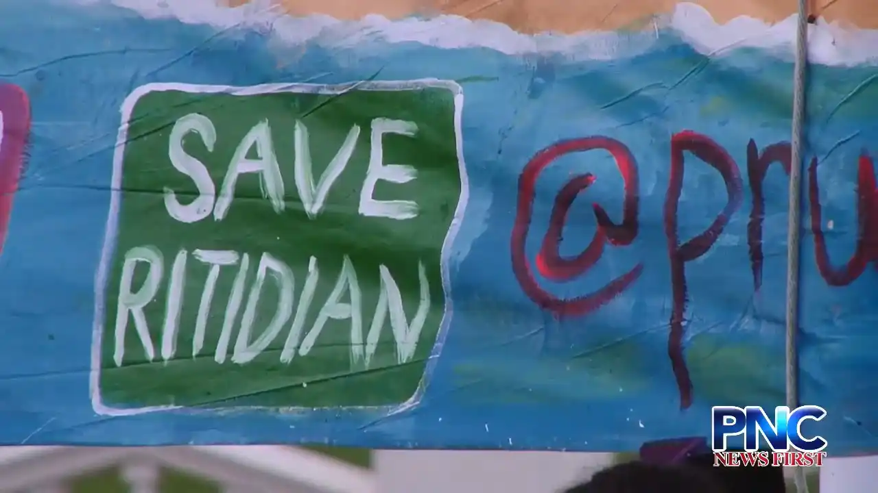
Protest Against Military Firing Range
This video highlights a peaceful protest organized by group Prutehi Litekyan. People marched to the Governor of Guam’s office to urge political leaders to stop the US military from clearing land in Litekyan (Ritidian) to build a firing range.
Featured in:
Decolonization in the Pacific, Module 3
-
Image
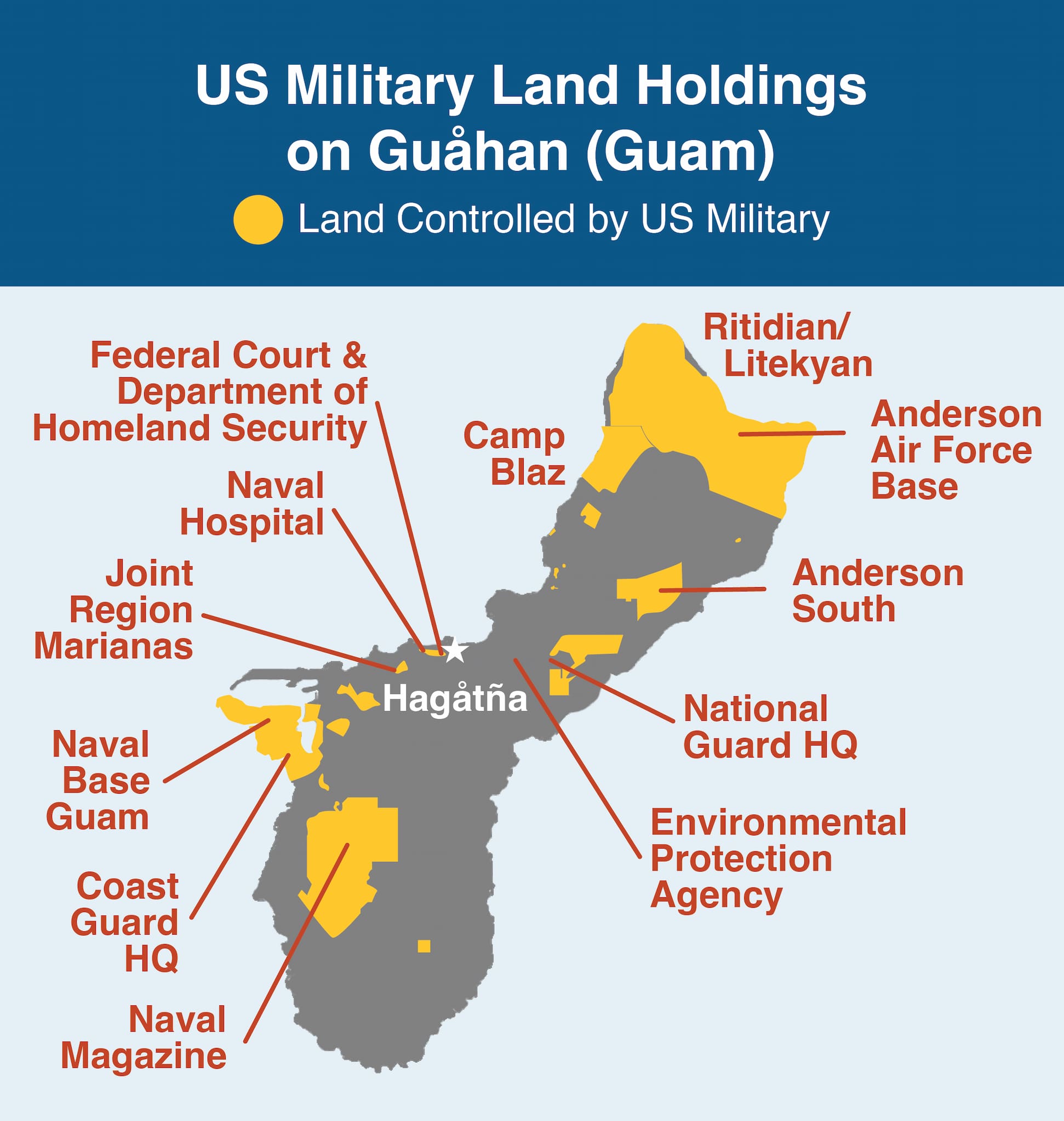
US Military Land Holdings on Guåhan (Guam)
This map shows the US military’s land holdings in the island of Guam. Roughly 27 percent of the island has bases or other installations that are controlled by the US military. These land holdings are found throughout the island.
Featured in:
Decolonization in the Pacific, Module 3
-
Video
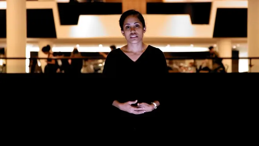
History Project
History Project was written and performed by Marshallese poet Kathy Jetn̄il-Kijiner at the Southbank Centre in London (2012). The poem tells the world of the destruction that colonialism and nuclear testing brought upon the people of the Marshall Islands.
Featured in:
Decolonization in the Pacific, Module 3
-
Image
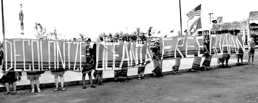
Decolonize Oceania Banner
At the 2016 Festival of the Pacific Arts, held in Guam, twelve delegates from Guam revealed banners that read “Decolonize Oceania, Free Guahan” as a message and a reminder that parts of the Pacific are still under colonial rule.
Featured in:
Decolonization in the Pacific, Module 2
-
Video
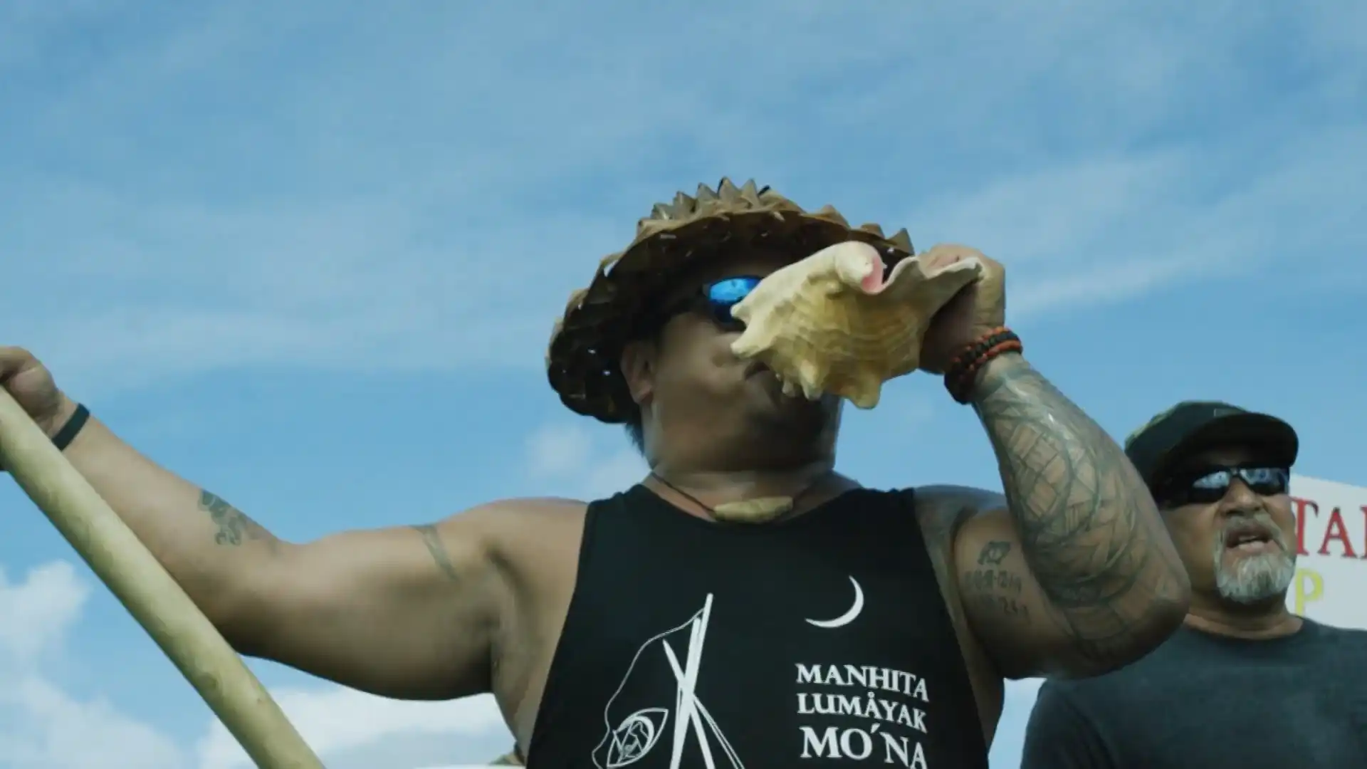
Quest for Decolonization
This video highlights the Dos Mit (2,000) March held in Guam in September 2019. Over 2,000 people gathered at the Governor’s Complex to advocate changing the political status of Guam as an unincorporated territory of the United States.
Featured in:
Decolonization in the Pacific, Module 2
-
Video
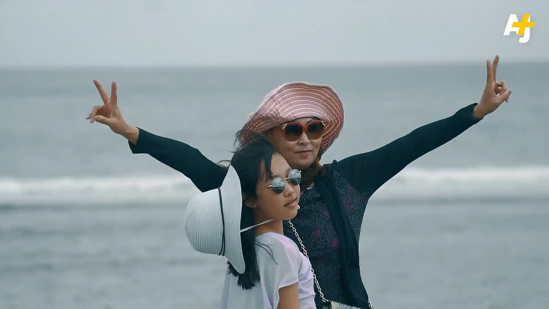
Colonial History of Guam
This clip from the AJ+ Untold America series underscores how Guam’s status as an unincorporated territory of the US excludes its citizens from constitutional protection, despite technical categorization as US citizens.
Featured in:
Decolonization in the Pacific, Module 2
-
Text
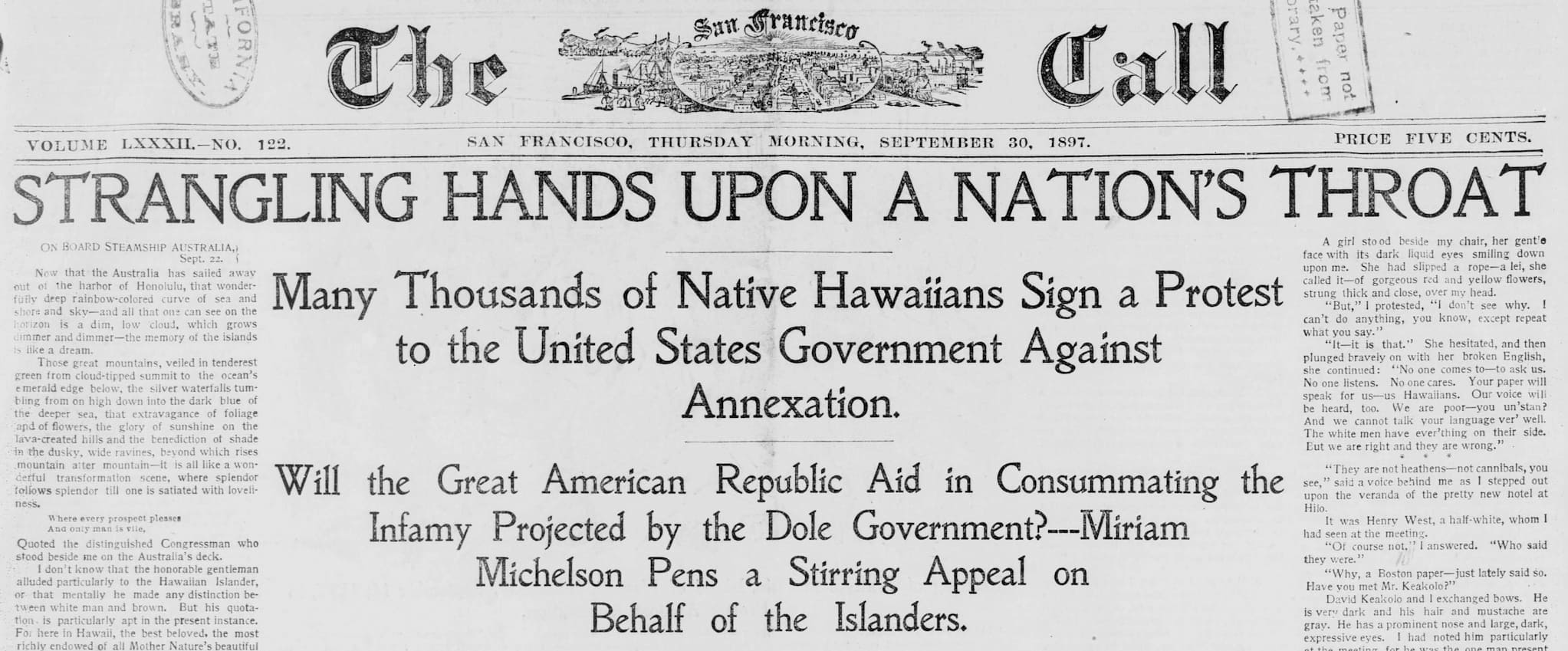
Hawaiians Protest U.S. Annexation
In an 1897 article published in The San Francisco Call, journalist Miriam Michelson’s headline, “Strangling Hands Upon A Nation’s Throat,” sheds light on the thousands of Hawaiians who protested against the United States’ illegal annexation of the Kingdom of Hawaiʻi.
Featured in:
Decolonization in the Pacific, Module 2
-
Image
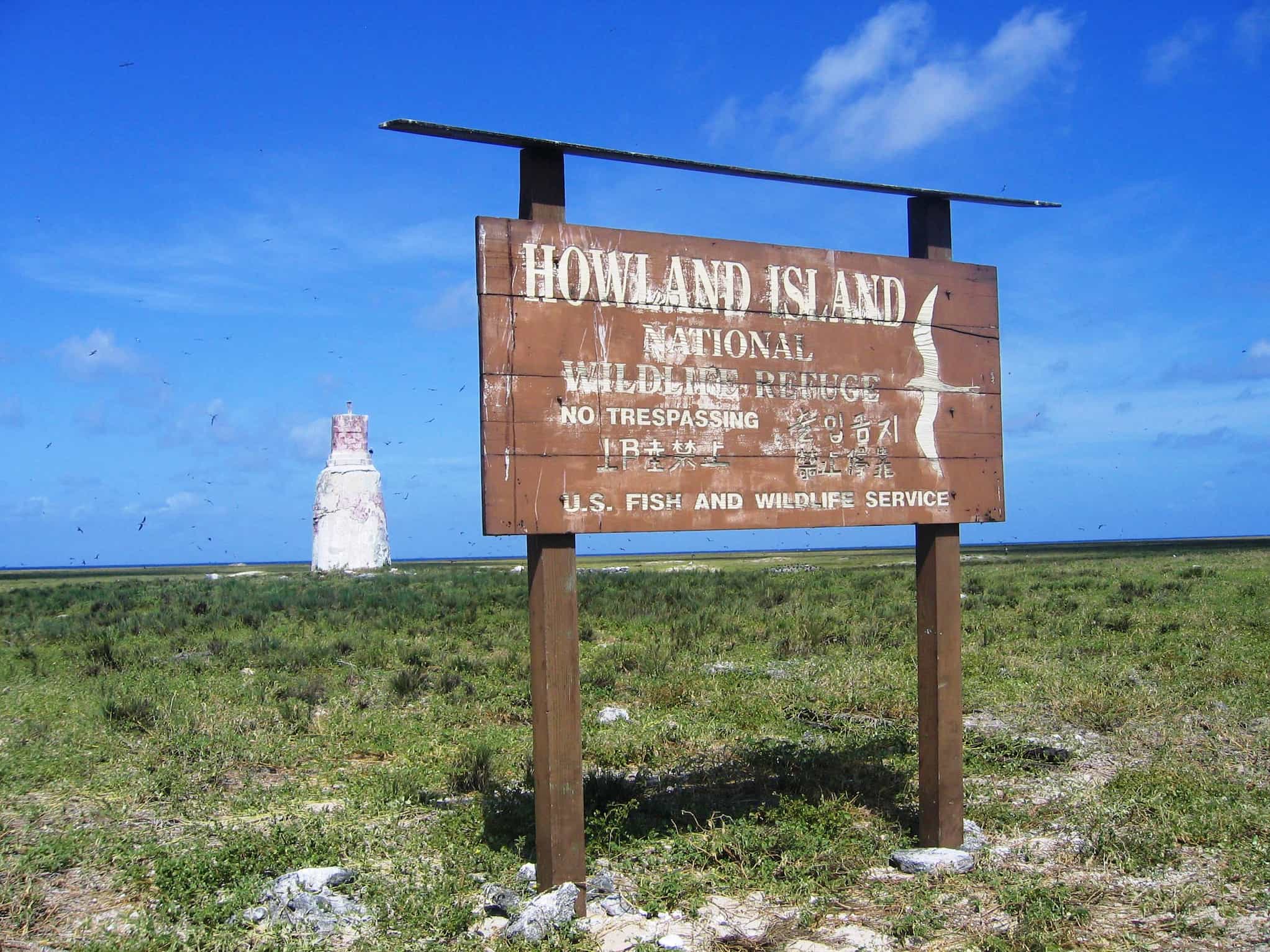
Howland Island
This sign stands at Howland Island. Today, the island is left abandoned by the US. Similar signs can be found in Baker Island and Jarvis Island. Currently, these islands are overseen by the US Fish and Wildlife Service.
Featured in:
Decolonization in the Pacific, Module 2
-
Image
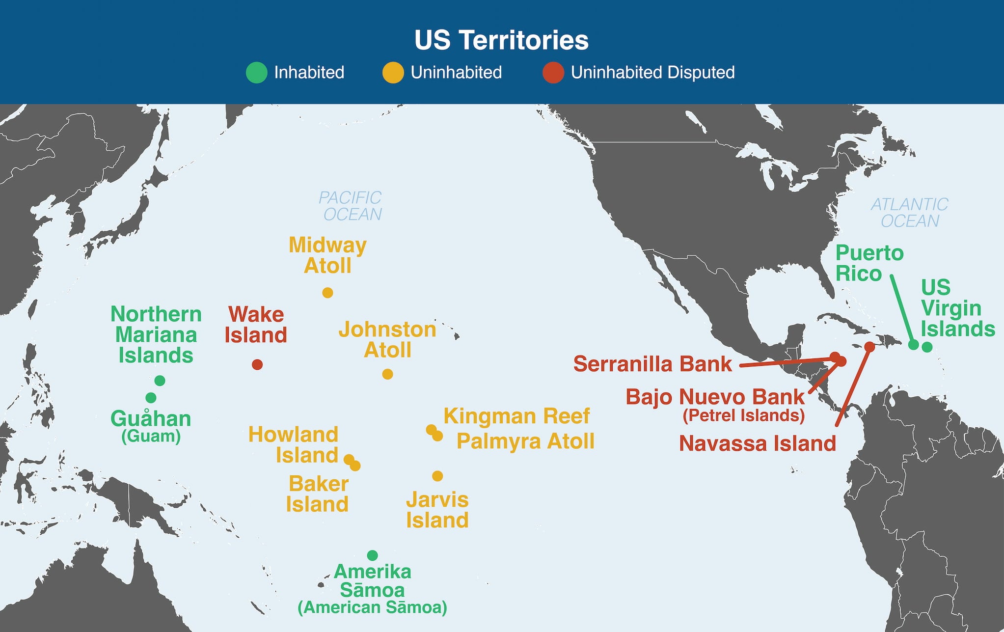
Map of US Territories
This map shows the fourteen territories currently controlled by the United States, most of which are located in the Pacific.
Featured in:
Decolonization in the Pacific, Module 2
-
Video
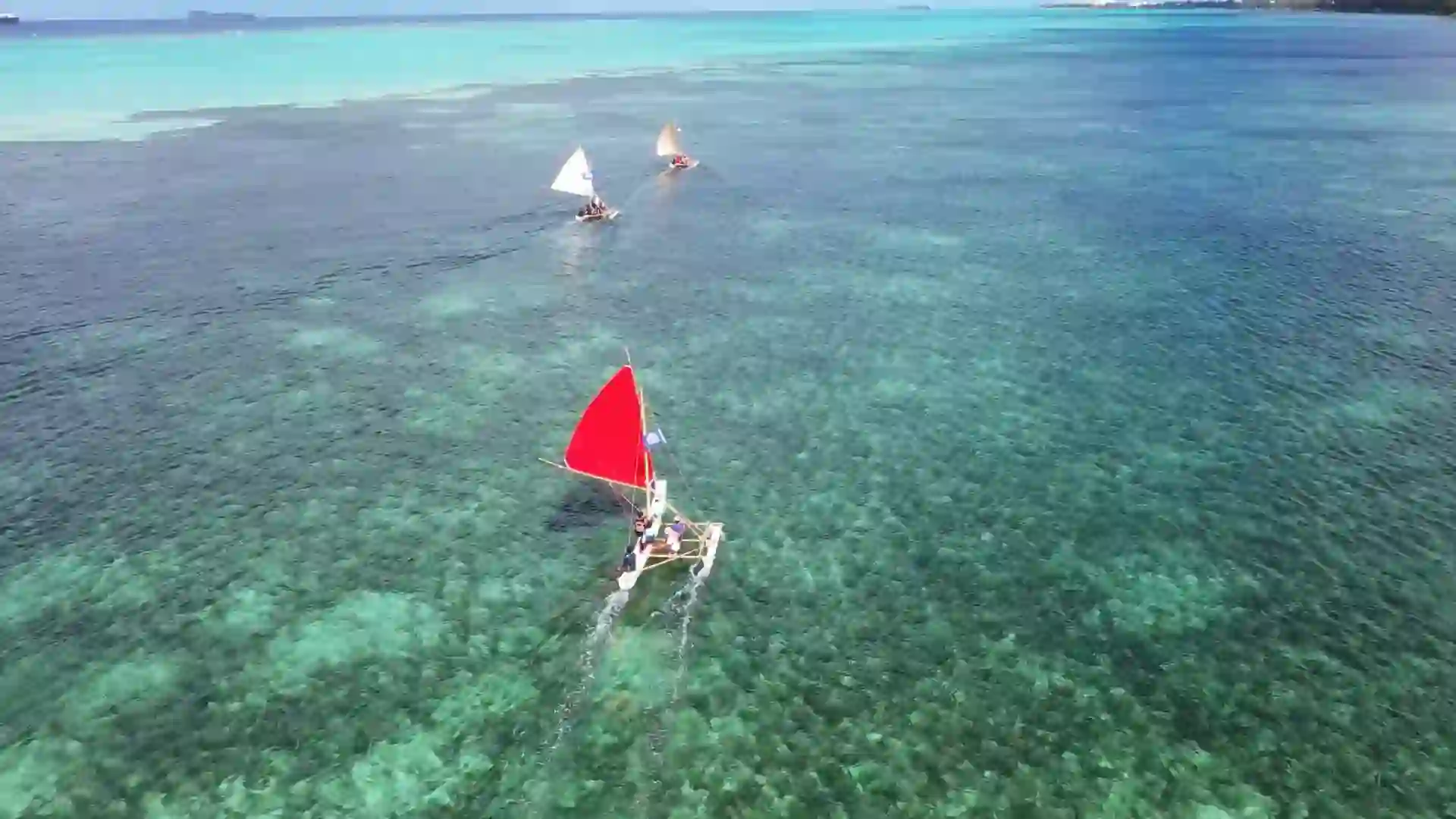
Navigating Cultures
Islanders were world experts at navigating the ocean using the waves, stars, and other aspects of nature as their guide. There is an active push in the Pacific to ensure that the seafaring culture continues with future generations.
Featured in:
Decolonization in the Pacific, Module 1