



Search the Media Repository
Discover the curated images, videos, and primary sources featured throughout Foundations and Futures
History is more than just text on a page; it is the photographs, voices, and artifacts of the people who lived it. The images and recordings featured across Foundations and Futures are part of a meticulously curated media repository. Whether you are building a lesson plan or investigating an artifact, you can use this database to trace the provenance of our media: discover who created an asset, the historical context behind it, and how it can be used to bring Asian American and Pacific Islander experiences into your classroom.
Multimedia
Chapters
-
Image
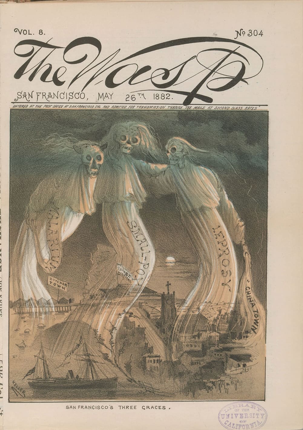
Three Graces
The cover of The Wasp magazine from May 26, 1882, associates San Francisco’s Chinatown with “malaria,” “small-pox,” and “leprosy.” The portrayal of Chinese migrants as diseased began with coolies, and was one of several justifications provided by lawmakers to exclude Chinese and other Asian migrants from entry to the US.
-
Image
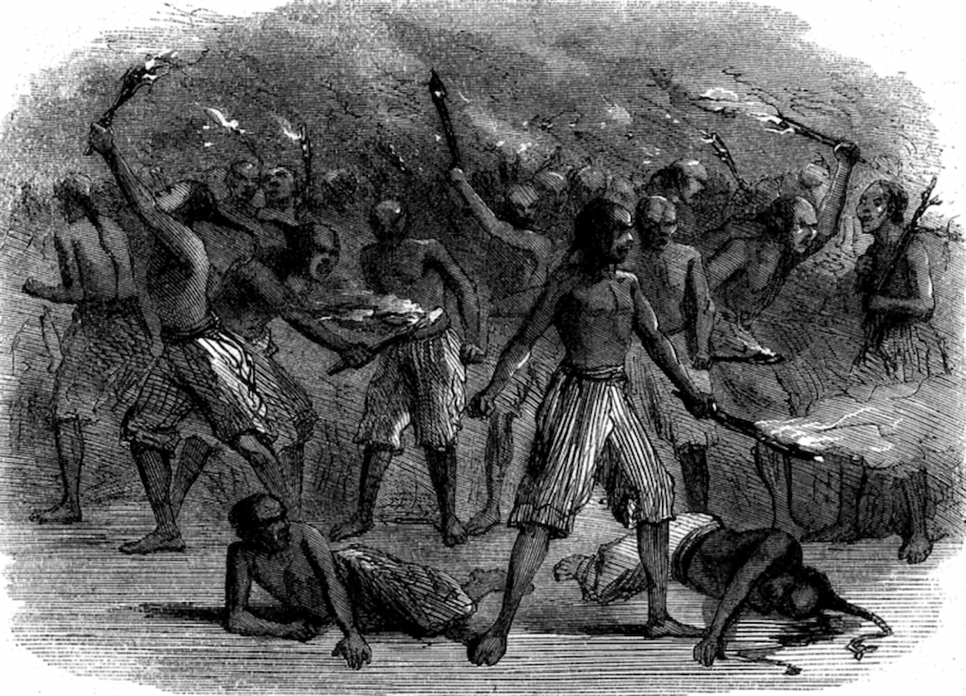
On the Lower Deck
An illustration by Edward Holden titled “On the Lower Deck,” and published in Harper’s New Monthly magazine in June of 1864, shows “heathen coolies” preparing to mutiny. Coolies were alternatively depicted as weak and slavish or dangerous heathens ready to disrupt the moral order.
-
Image
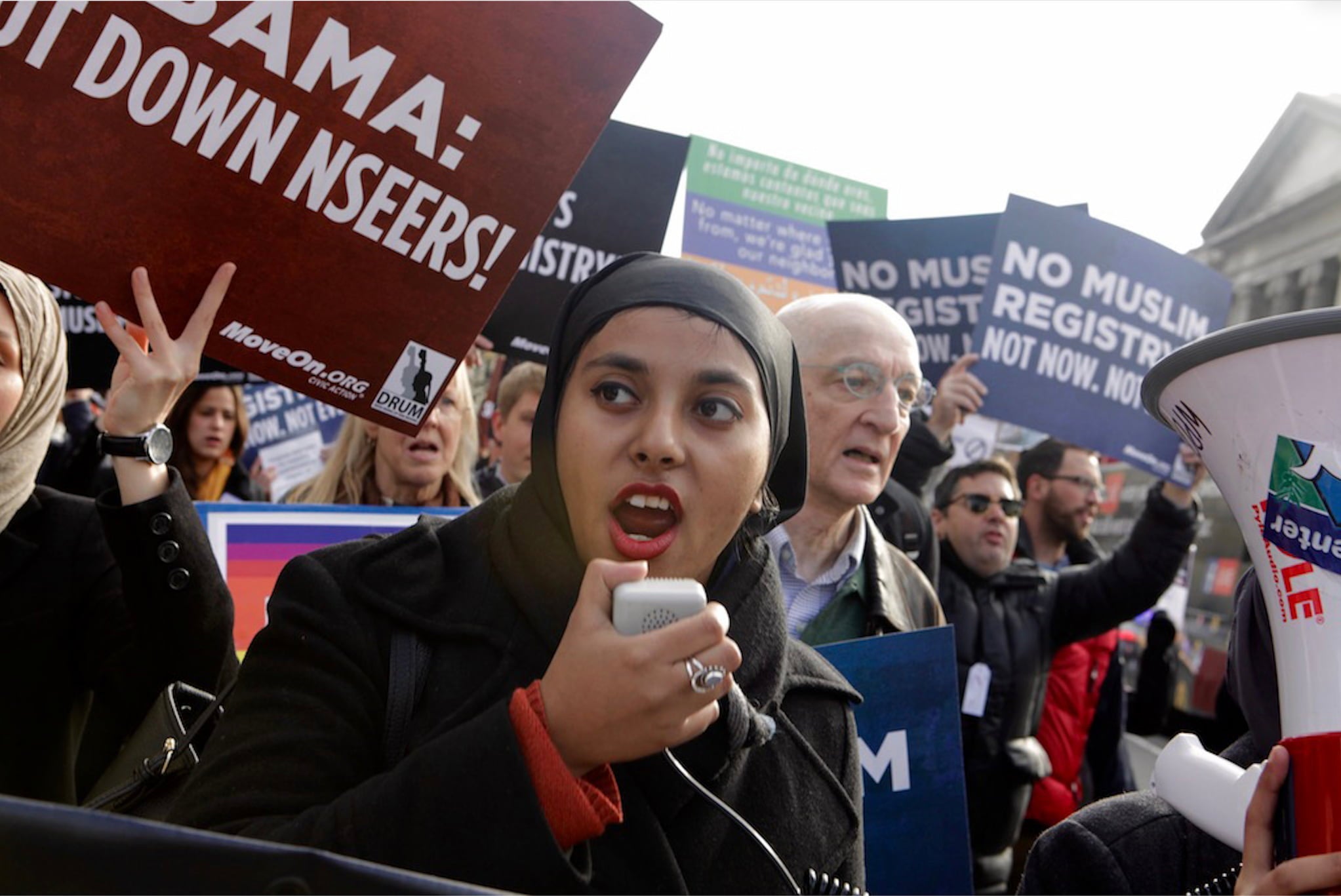
Protest On Muslim Registry
Activists in Washington, DC, protest the National Security Entry-Exit Registration System (NSEERS), which racially profiled South Asian, Muslim, and Arab American communities.
-
Image
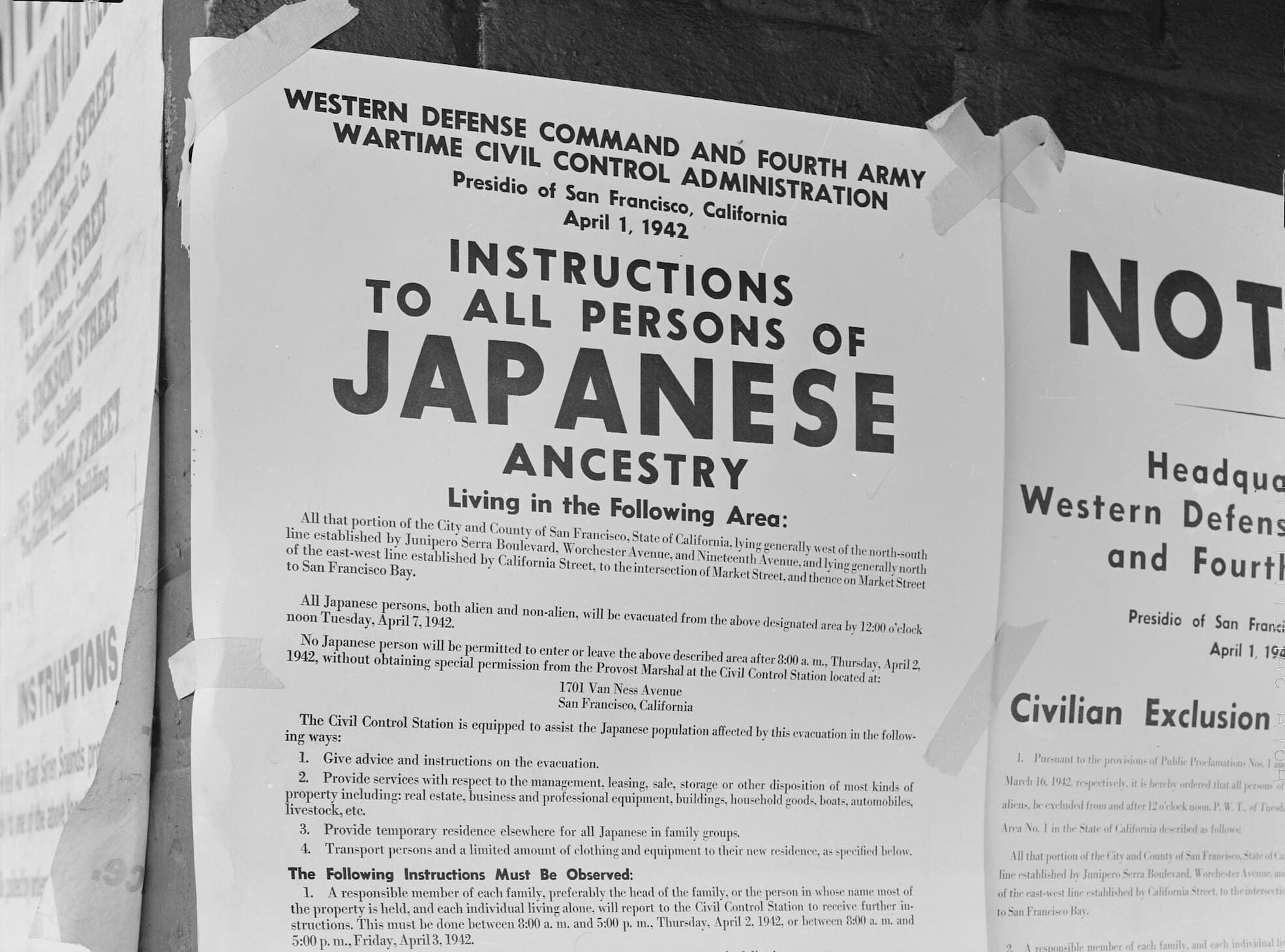
Posted Exclusion Orders
Posters displayed in San Francisco, California, in 1942 ordered the mandatory “evacuation” of Japanese Americans from the Western United States during WWII. Citation: Unknown, “Posted Exclusion Orders,” photograph, April 11, 1942, Densho.org.
-
Image
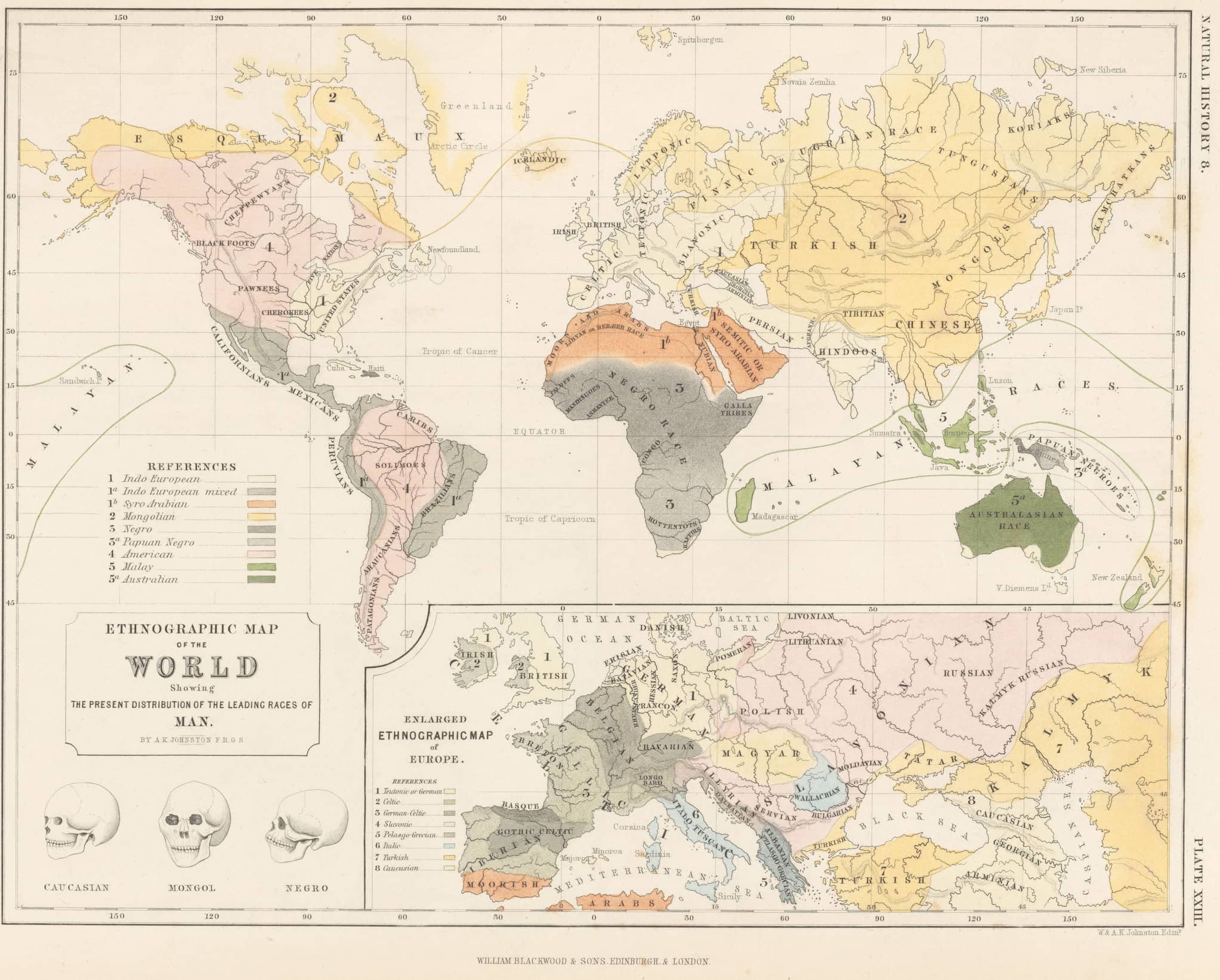
Leading Races of Man Map
German naturalist and physician Johann Friedrich Blumenbach claimed there were five human races and attempted to indicate the boundaries of each racialized group as shown in this map from 1889.
-
Text
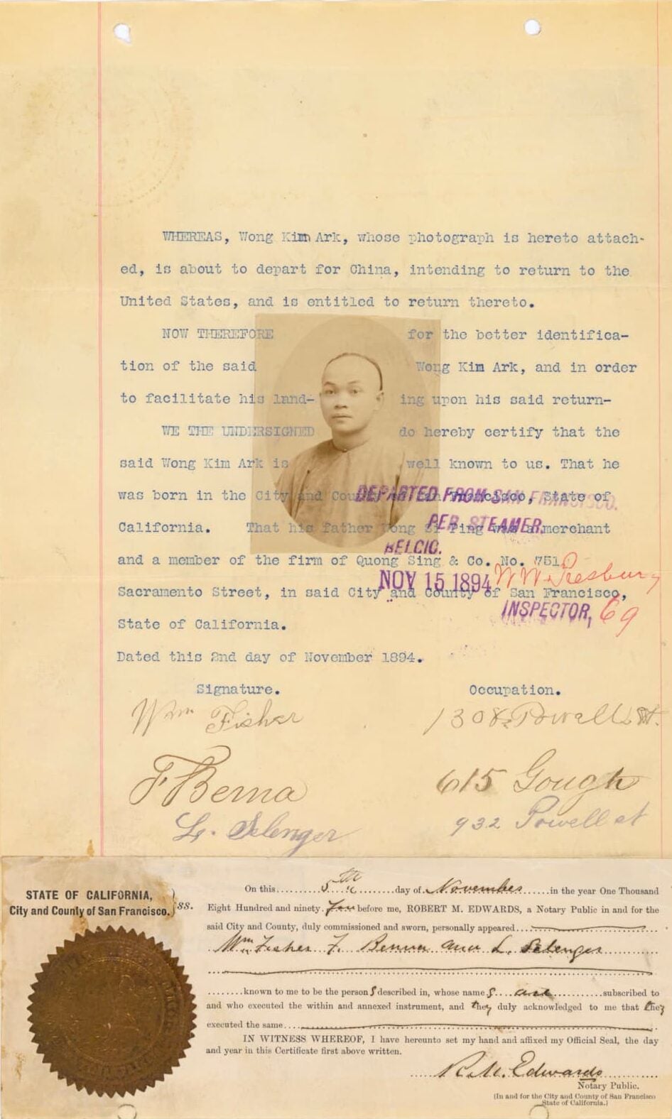
Wong Kim Departure Statement
In 1894, Wong Kim Ark traveled to China to see his family. Despite these notarized re-entry papers, Wong was detained and denied reentry.
-
Image
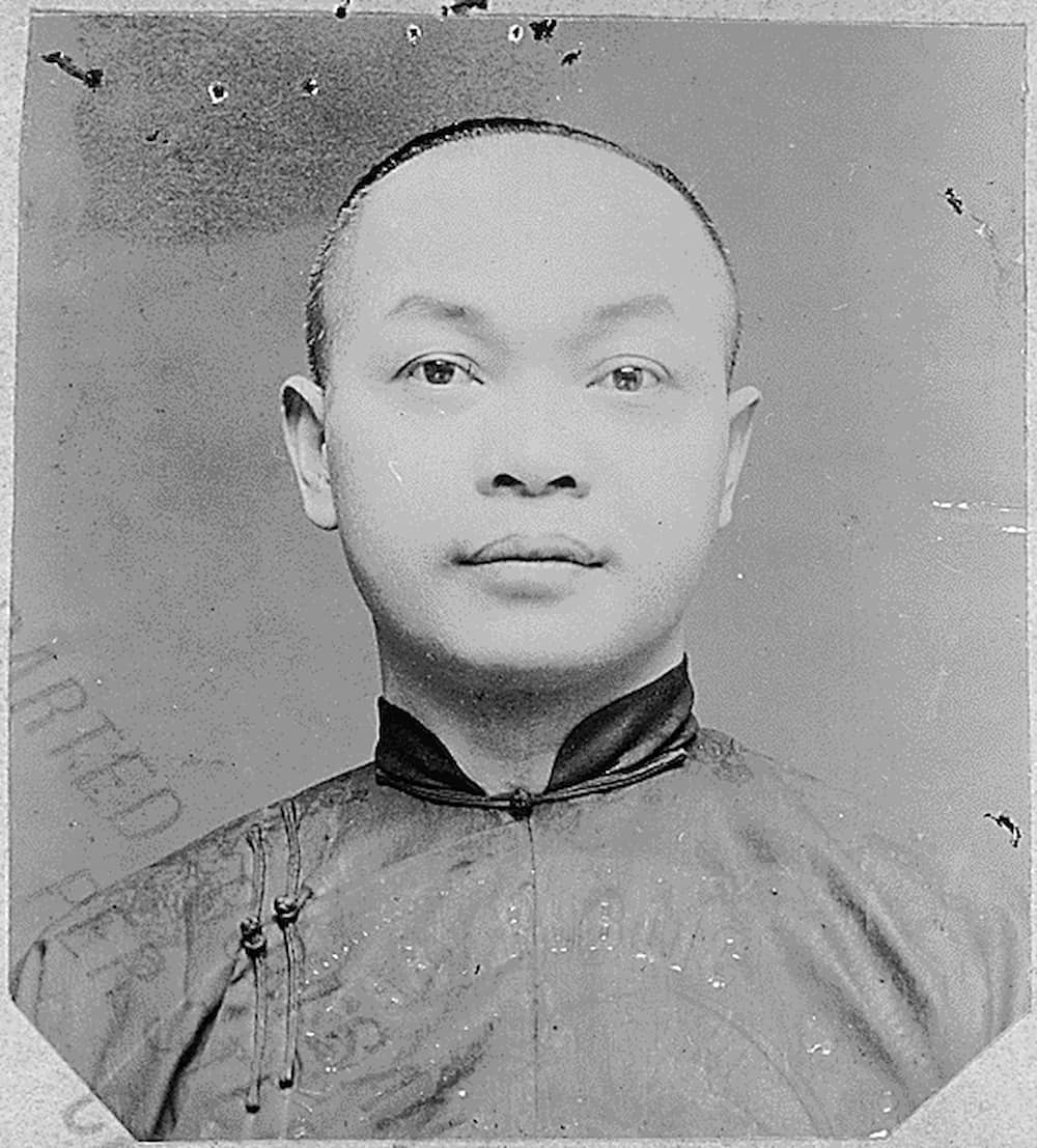
Wong Kim Ark ID
A photo of Wong Kim Ark from a federal investigation case
-
Image
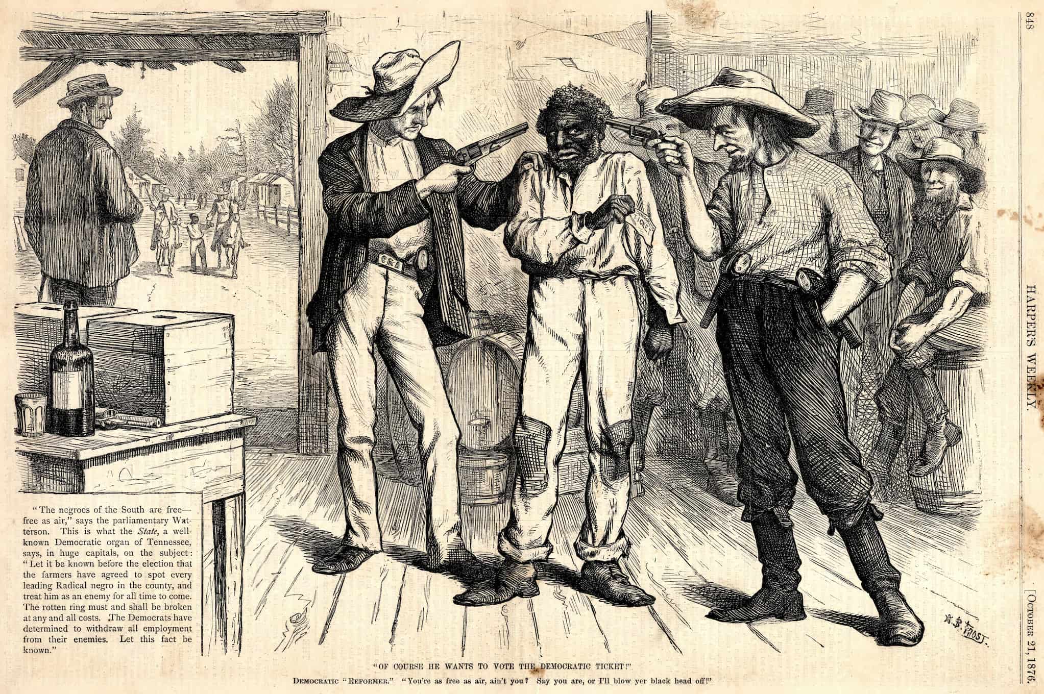
Of Course He Wants to Vote the Democratic Ticket!
An illustration from Harper’s Weekly (1876) illustrates the intimidation, suppression, and outright violence that Black voters faced during the Reconstruction Era and after.
-
Image
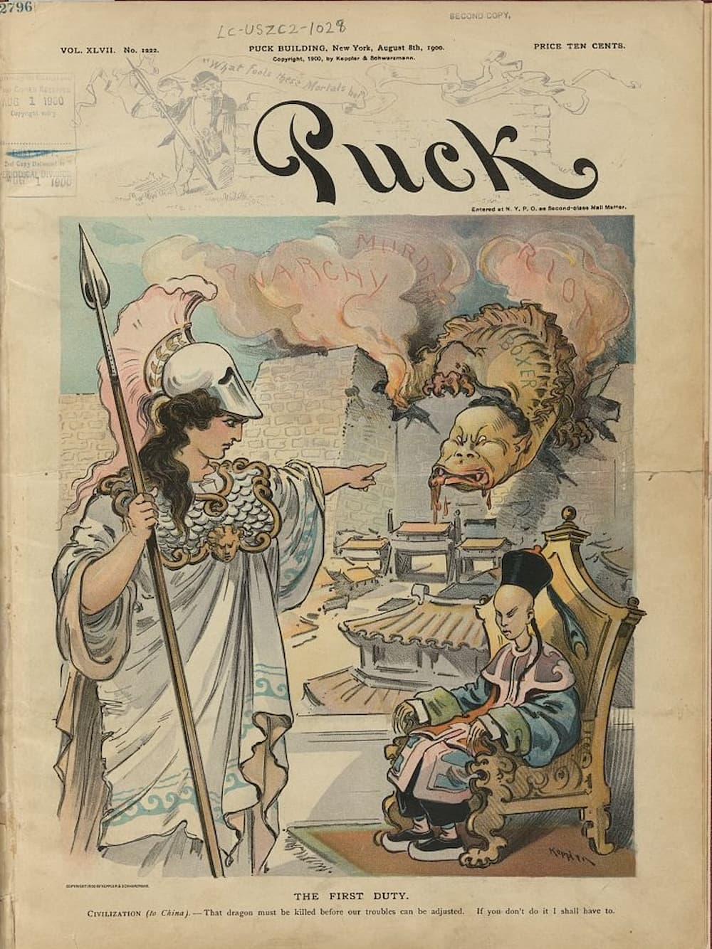
The First Duty
The cover of Puck magazine from 1900 reads, “That dragon must be killed before our troubles can be adjusted. If you don’t do it I shall have to.”
-
Image
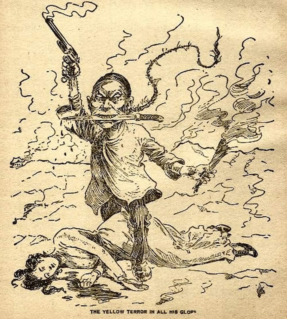
The Yellow Terror in all His Glory
“The Yellow Terror in All His Glory,” an 1899 cartoon about the Boxer Rebellion in China, helped to inflame Western rhetoric about a “Yellow Peril.”
-
Text
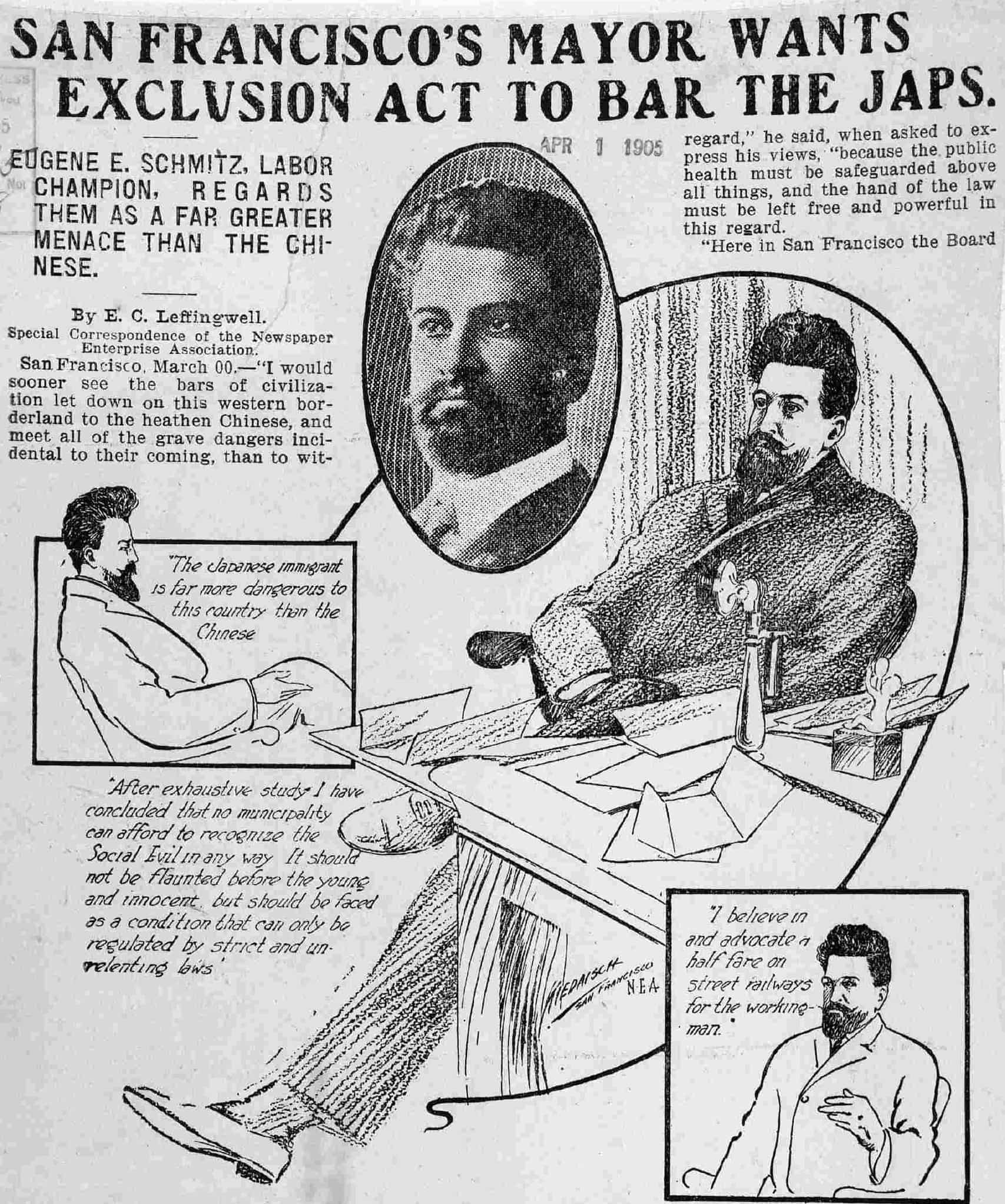
SF Mayor Wants Exclusion
San Francisco mayor Eugene Schmitz ran on an anti-Japanese campaign. The segregation of Japanese American students in separate schools led to the Gentlemen’s Agreement of 1907.
-
Image
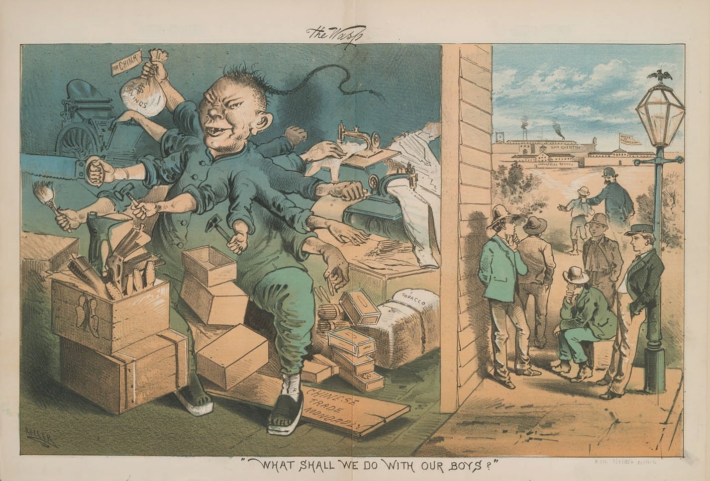
What Shall We Do With Our Boys?
Political cartoons in the late nineteenth century depicted Chinese migrants as diseased, dangerous, and sinister. This cartoon by George Frederick Keller was created in the same year as the passage of the Chinese Exclusion Act and shows a caricatured Chinese labor as an economic threat.
-
Video
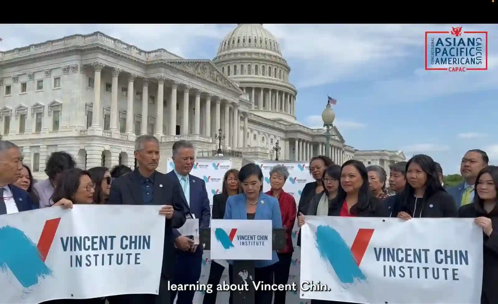
Launch of Vincent Chin Institute
On April 26, 2023, Congresswoman Judy Chu and other leaders celebrated the launch of the Vincent Chin Institute, established to fight hate through multiracial solidarity, education, advocacy networks and telling our own stories—all legacies of the Vincent Chin movement.
-
Video
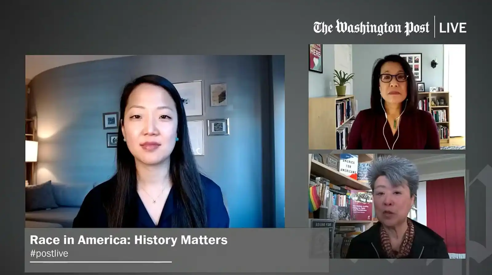
History’s Importance In Fight For Justice
Author Helen Zia (lower right) describes the historic patterns that have continued during the COVID-19 pandemic in this Washington Post video.
-
Video
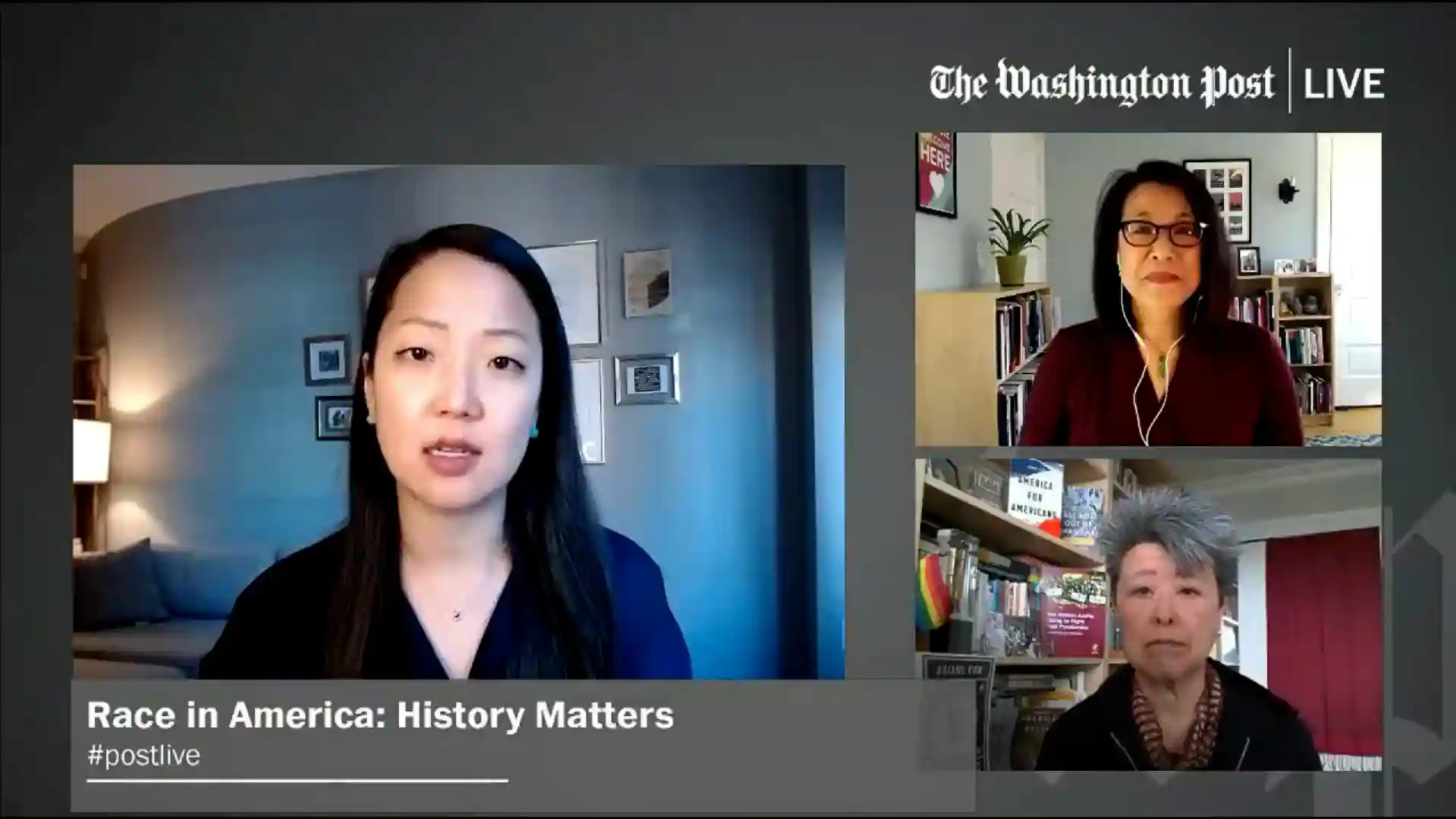
History of Anti-Asian Rhetoric
During the dual pandemics of COVID and anti-Asian hate, many Asian Americans spoke out. Author and historian Erica Lee (top right) speaks in a Washington Post video on the history and contemporary rise of racist incidents and violence.
-
Image
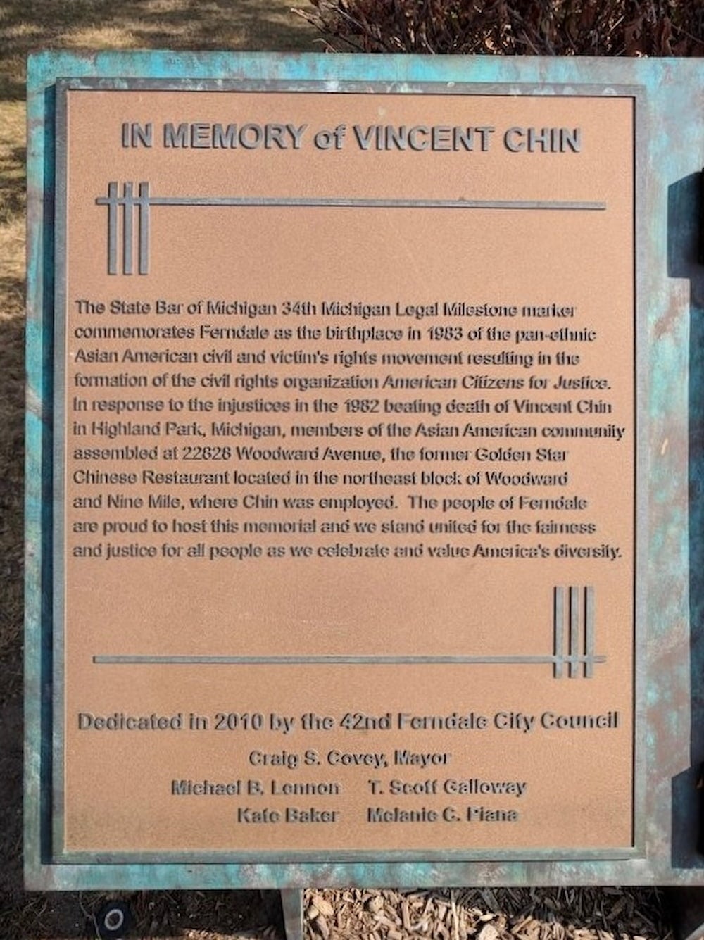
Vincent Chin Plaque
On Woodward Avenue, a main thoroughfare of greater Detroit, this historic plaque honors the memory of Vincent Chin in the median at the intersection of Nine Mile Road in Ferndale, across from the building Vincent had worked as a waiter.
-
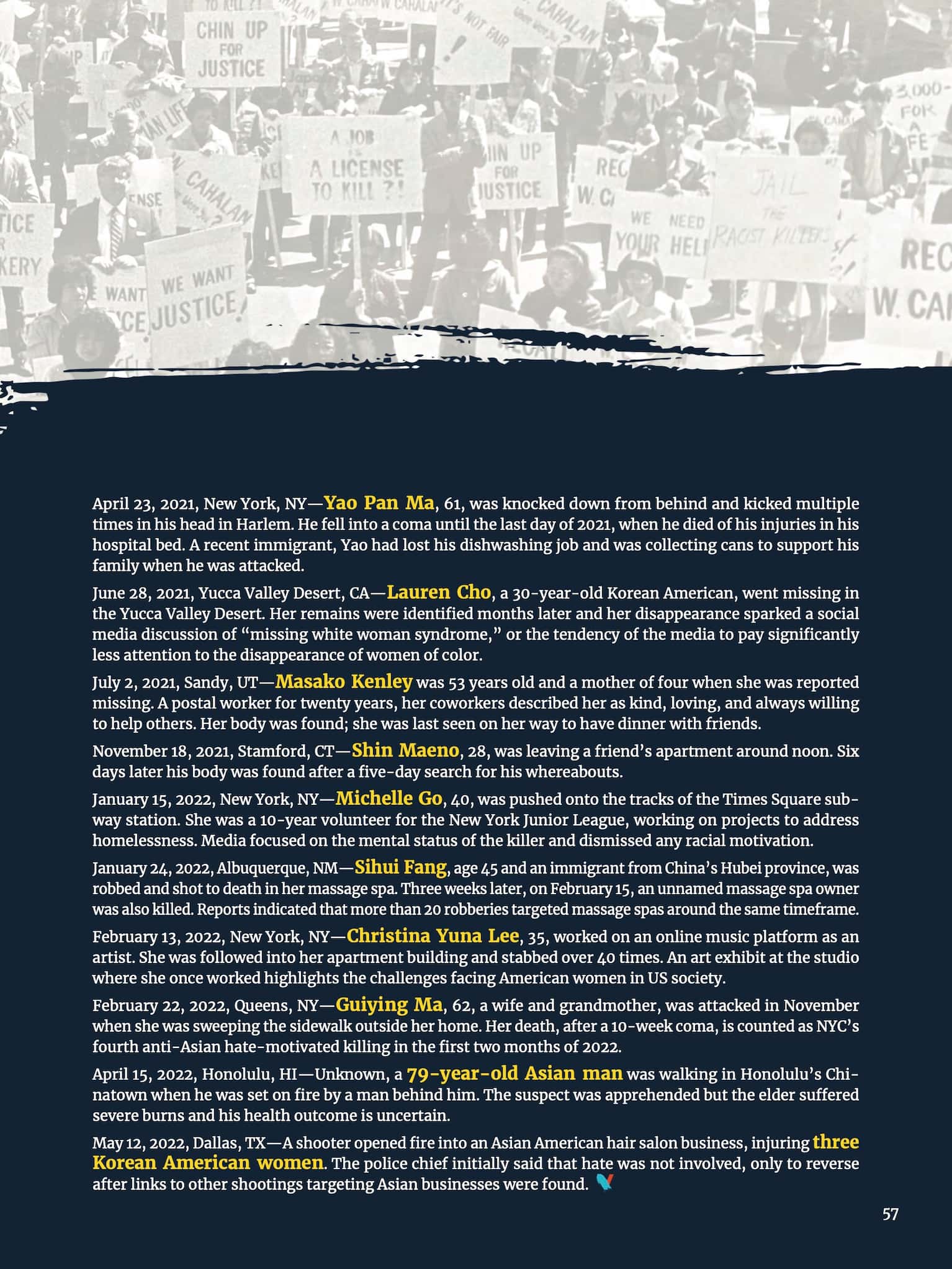
Text
The Vincent Chin Legacy Guide (Page 4)
Though Vincent Chin’s case is a landmark of anti-Asian violence, many other Asian Americans have been harmed, with a few more listed here. Even today, racism against Asians is often denied and ignored by authorities, media and society in general.
-
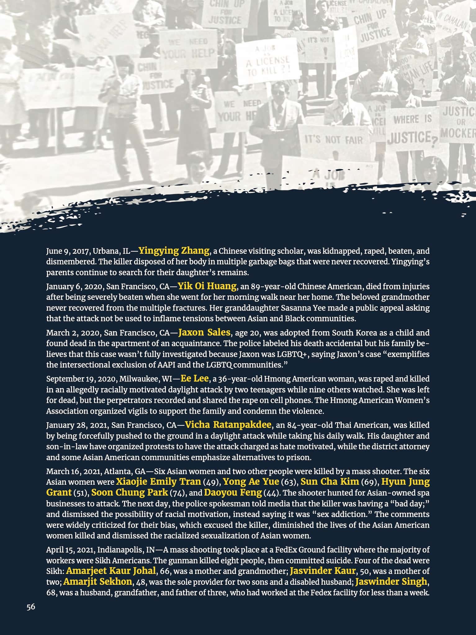
Text
The Vincent Chin Legacy Guide (Page 3)
Though Vincent Chin’s case is a landmark of anti-Asian violence, many other Asian Americans have been harmed, with a few more listed here. Even today, racism against Asians is often denied and ignored by authorities, media and society in general.
-
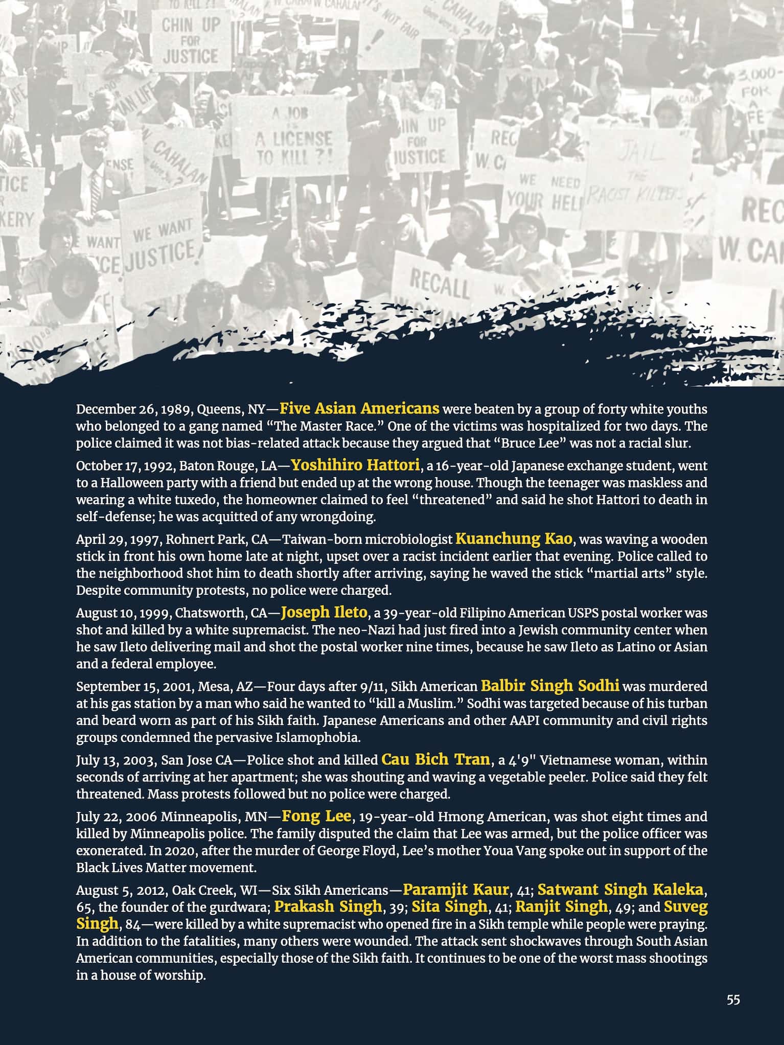
Text
The Vincent Chin Legacy Guide (Page 2)
Though Vincent Chin’s case is a landmark of anti-Asian violence, many other Asian Americans have been harmed, with a few more listed here. Even today, racism against Asians is often denied and ignored by authorities, media and society in general.
-
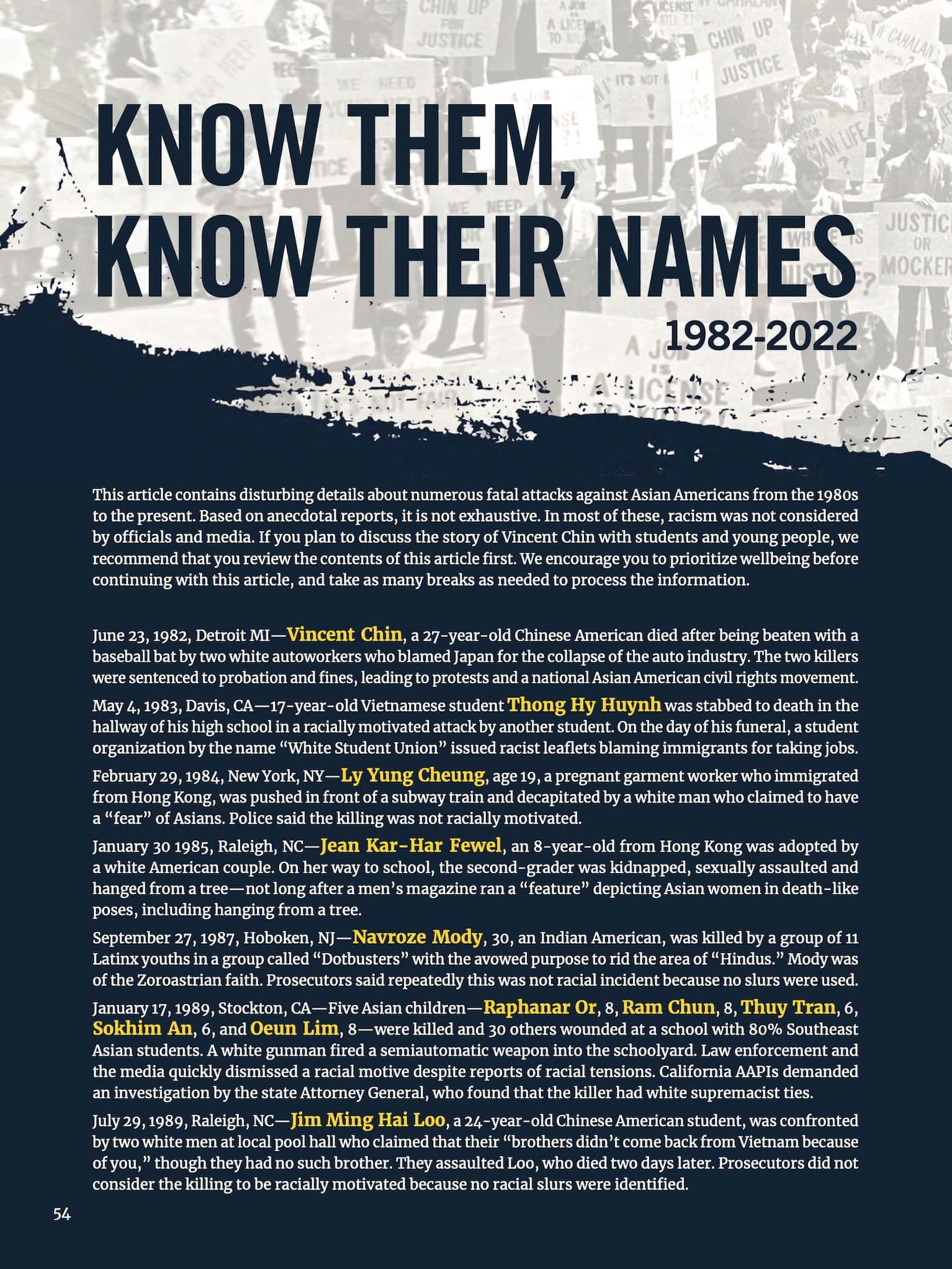
Text
The Vincent Chin Legacy Guide (Page 1)
Though Vincent Chin’s case is a landmark of anti-Asian violence, many other Asian Americans have been harmed, with a few more listed here. Even today, racism against Asians is often denied and ignored by authorities, media and society in general.