Search the Media Repository
Discover the curated images, videos, and primary sources featured throughout Foundations and Futures
History is more than just text on a page; it is the photographs, voices, and artifacts of the people who lived it. The images and recordings featured across Foundations and Futures are part of a meticulously curated media repository. Whether you are building a lesson plan or investigating an artifact, you can use this database to trace the provenance of our media: discover who created an asset, the historical context behind it, and how it can be used to bring Asian American and Pacific Islander experiences into your classroom.
Multimedia
Chapters
-
Image
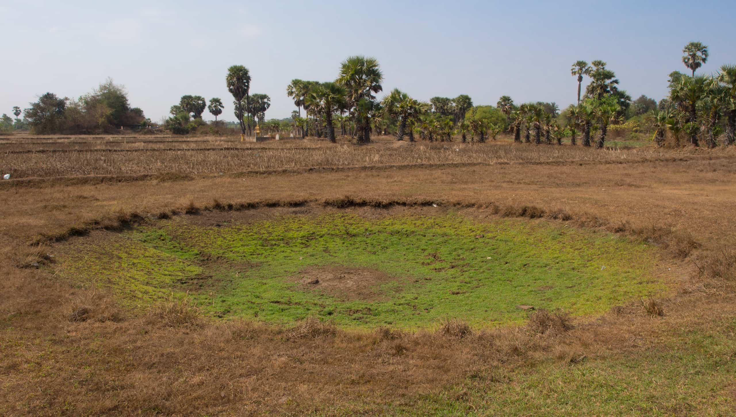
Bomb Crater in Kampong Cham Province, Cambodia
A bomb crater in Kampong Cham Province, Cambodia, photographed in 2014.
Featured in:
Cambodian Americans, Module 2
-
Image
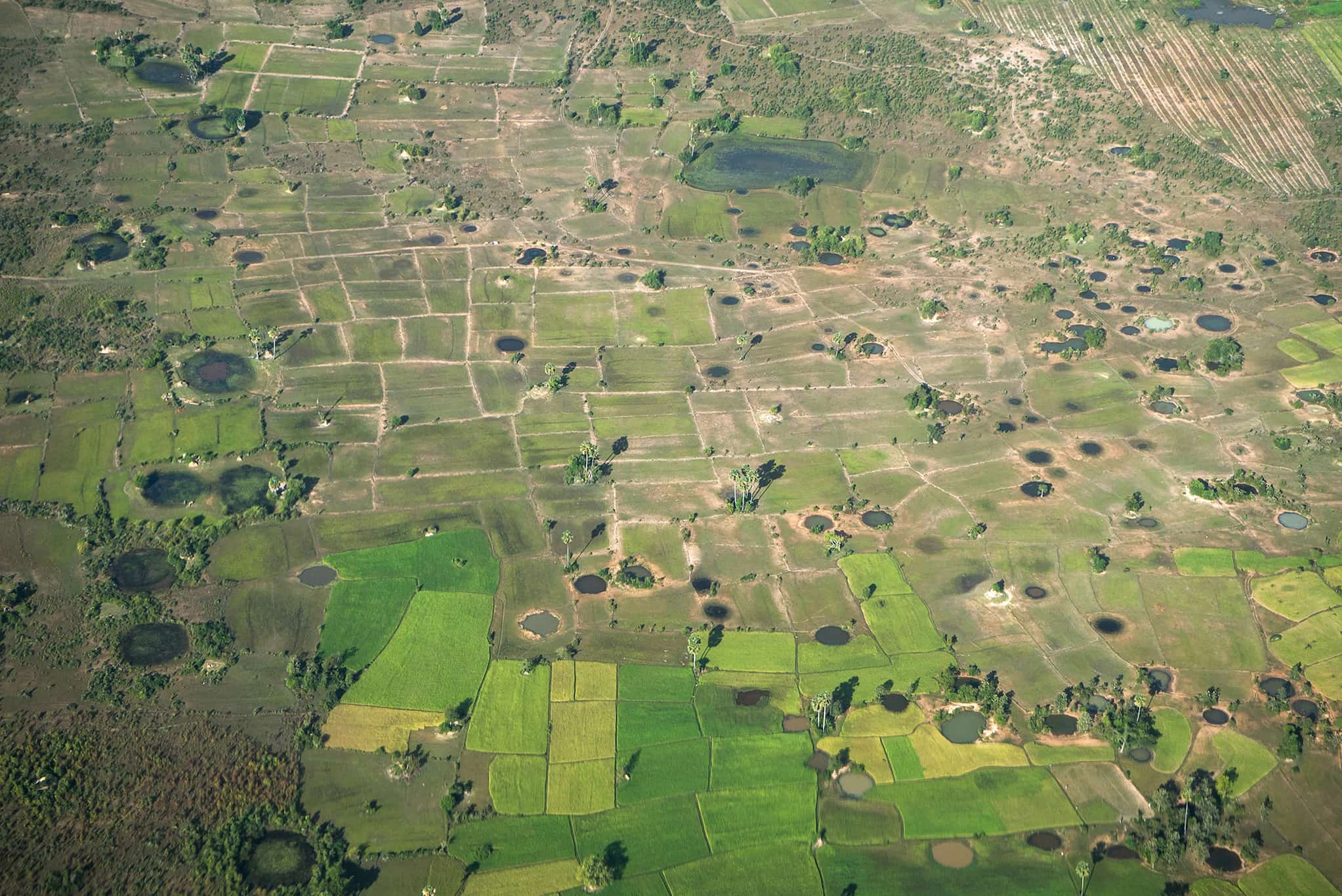
Aerial View of Bomb Craters in Cambodia
An overhead view of bomb craters from the US aerial bombardment in the 1960s and 1970s marking the fields in Kandal Province, Cambodia.
Featured in:
Cambodian Americans, Module 2
-
Image
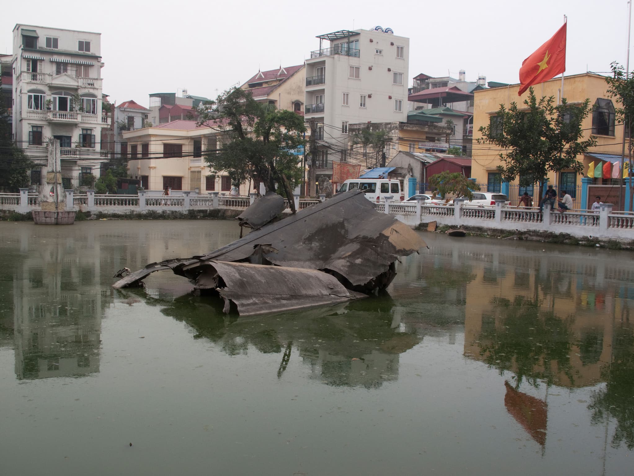
Wreckage of American B-52 Bomber
The wreckage of an American B-52 bomber, shot down during the Vietnam War on December 27, 1972, can be seen in Hữu Tiệp Lake in the Ngọc Hà neighborhood of Hanoi, Vietnam.
Featured in:
Cambodian Americans, Module 2
-
Video
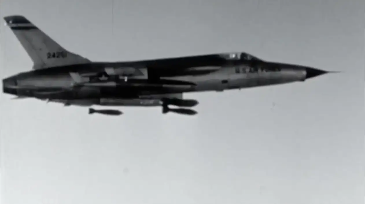
Operation Rolling Thunder
Footage from US Air Force and Naval air operations during Operation Rolling Thunder from March 1965 to November 1968 in Vietnam. Rolling Thunder was the most intense operation waged during the Cold War.
Featured in:
Cambodian Americans, Module 2
-
Image
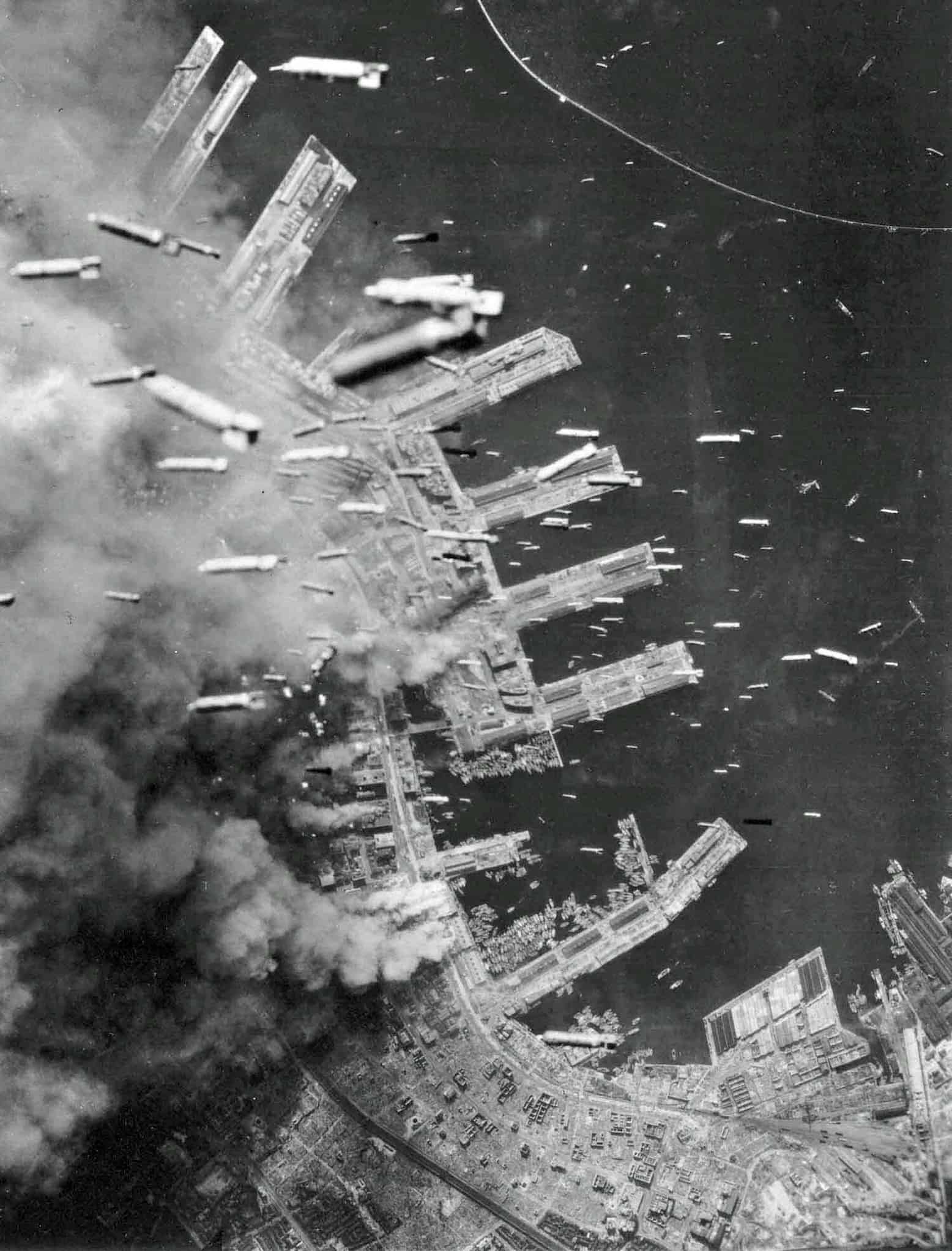
American Bombs Falling on Kobe
Taken from above on June 4, 1945, the image captures the dropping of incendiary bombs from American B-29 Superfortresses onto the burning city of Kobe, Japan.
Featured in:
Cambodian Americans, Module 2
-
Image
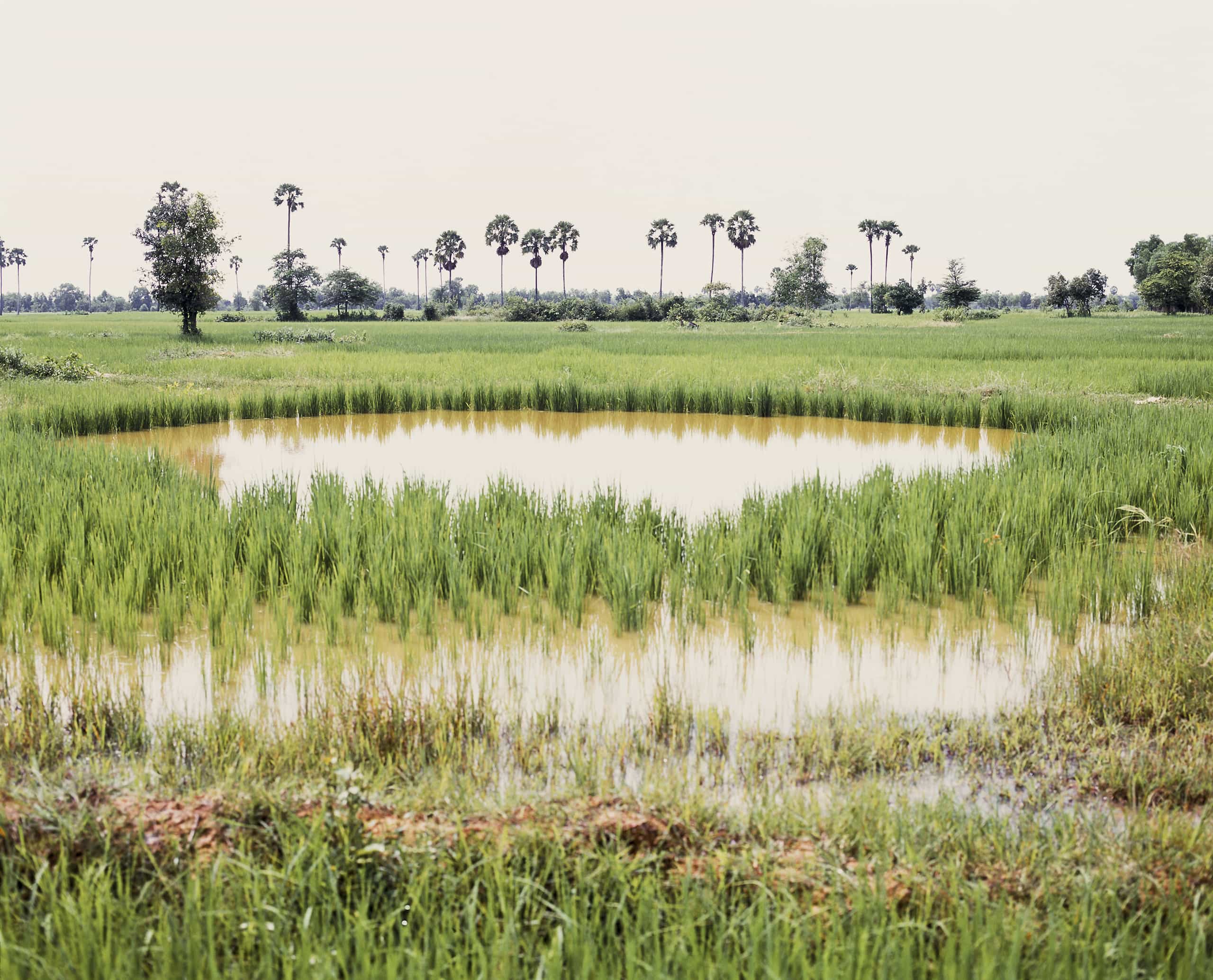
Takeo by Vandy Rattana
Takeo (2009) by artist and photographer Vandy Rattana, who lives and works between Phnom Penh, Paris, and Taipei. His series Bomb Ponds consists of several photographs and a film documenting the aftermath of U.S. bombing in Cambodia.
Featured in:
Cambodian Americans, Module 1
-
Image
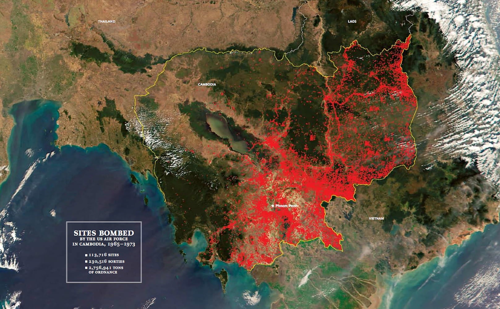
Map of U.S. Bombings of Cambodia, 1964-1975
This map illustrates the extent of US bombings of Cambodia from 1964 to 1975. The US dropped at least five hundred thousand tons of bombs on Cambodia. Each of the red dots in the map depicts a bombing target.
Featured in:
Cambodian Americans, Module 1
-
Image
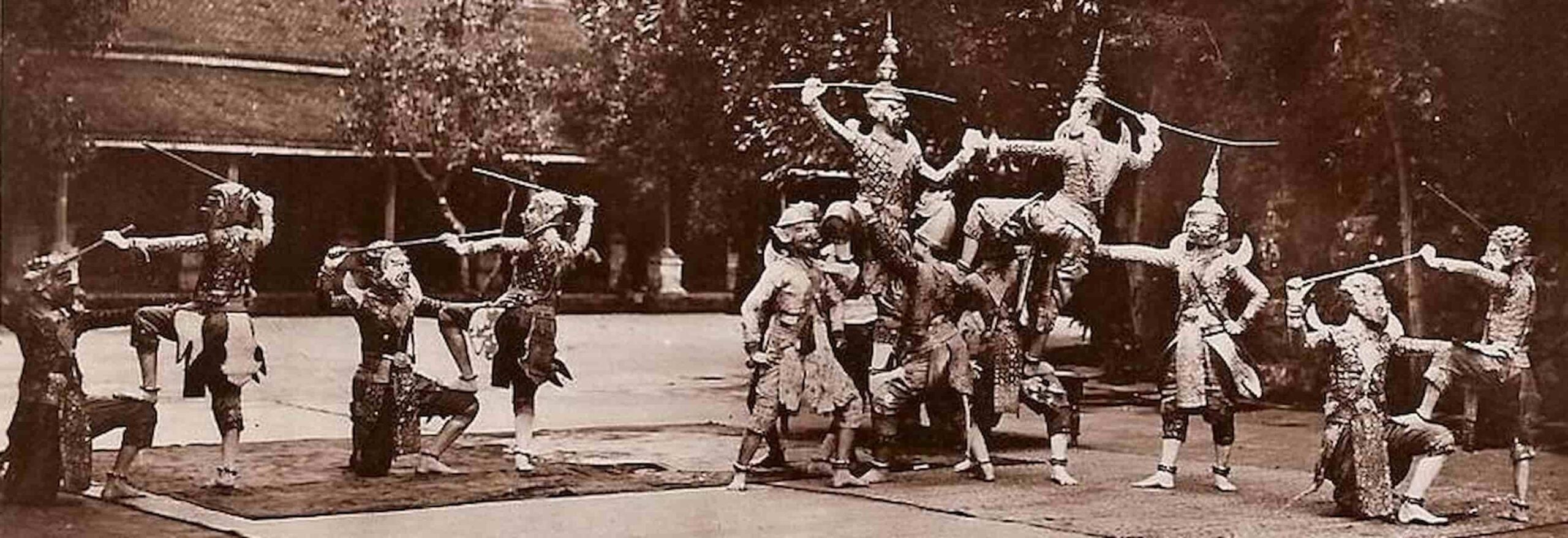
Reamker Performance Postcard
This image is from a postcard whose exact date of publication is unknown, but likely circa 1904. The image depicts a Lakhon Khol, a traditional masked theater practice, and a performance of the Reamker, the Cambodian epic poem based upon the Ramayana.
Featured in:
Cambodian Americans, Module 1
-
Image
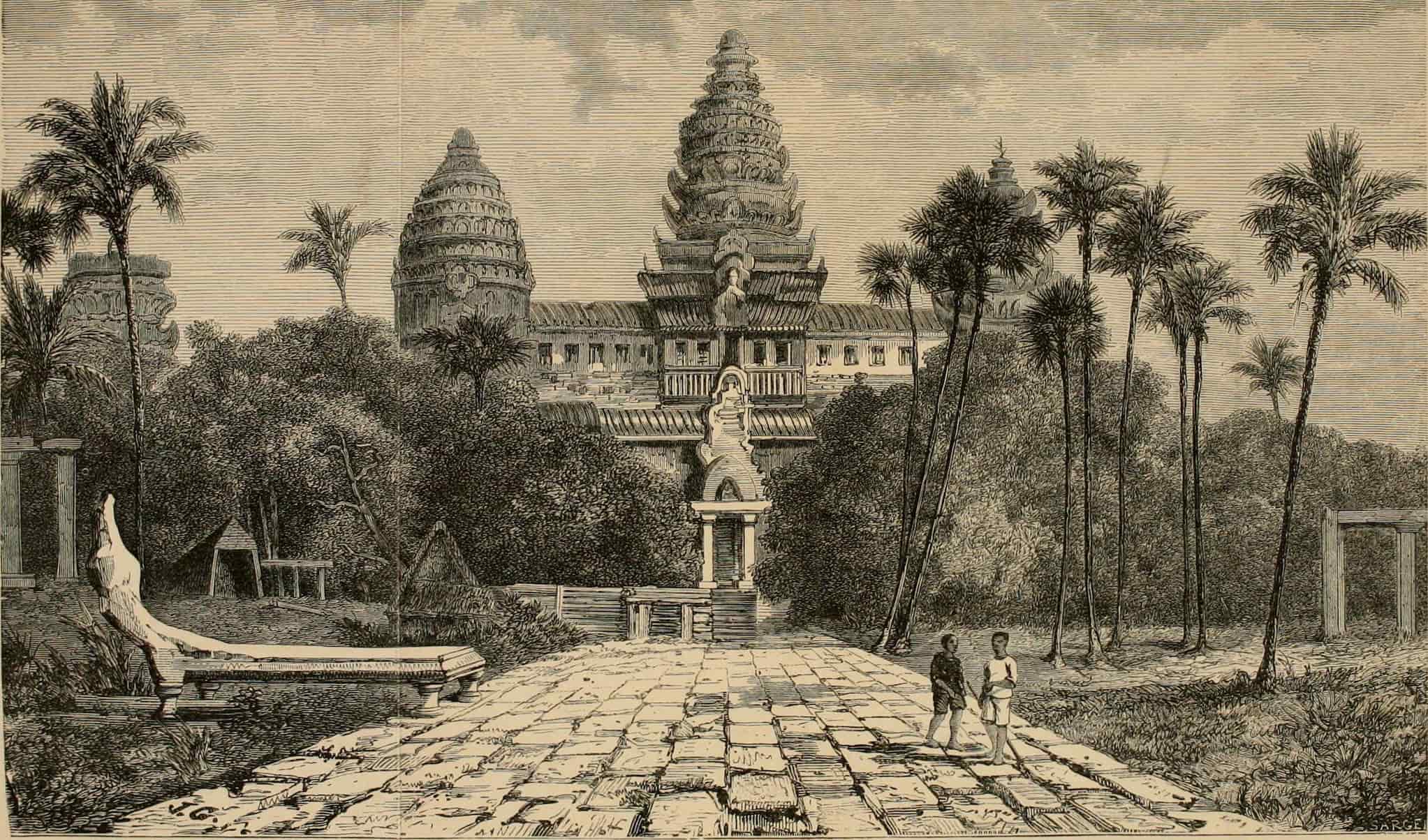
Angkor Wat Postcard
Henri Mouhot produced several sketches of Angkor during his travels in Southeast Asia. This image of Angkor Wat, circa 1860, included local people. These local people would be removed when Mouhot’s sketches were featured in France’s Tour du Monde.
Featured in:
Cambodian Americans, Module 1
-
Image
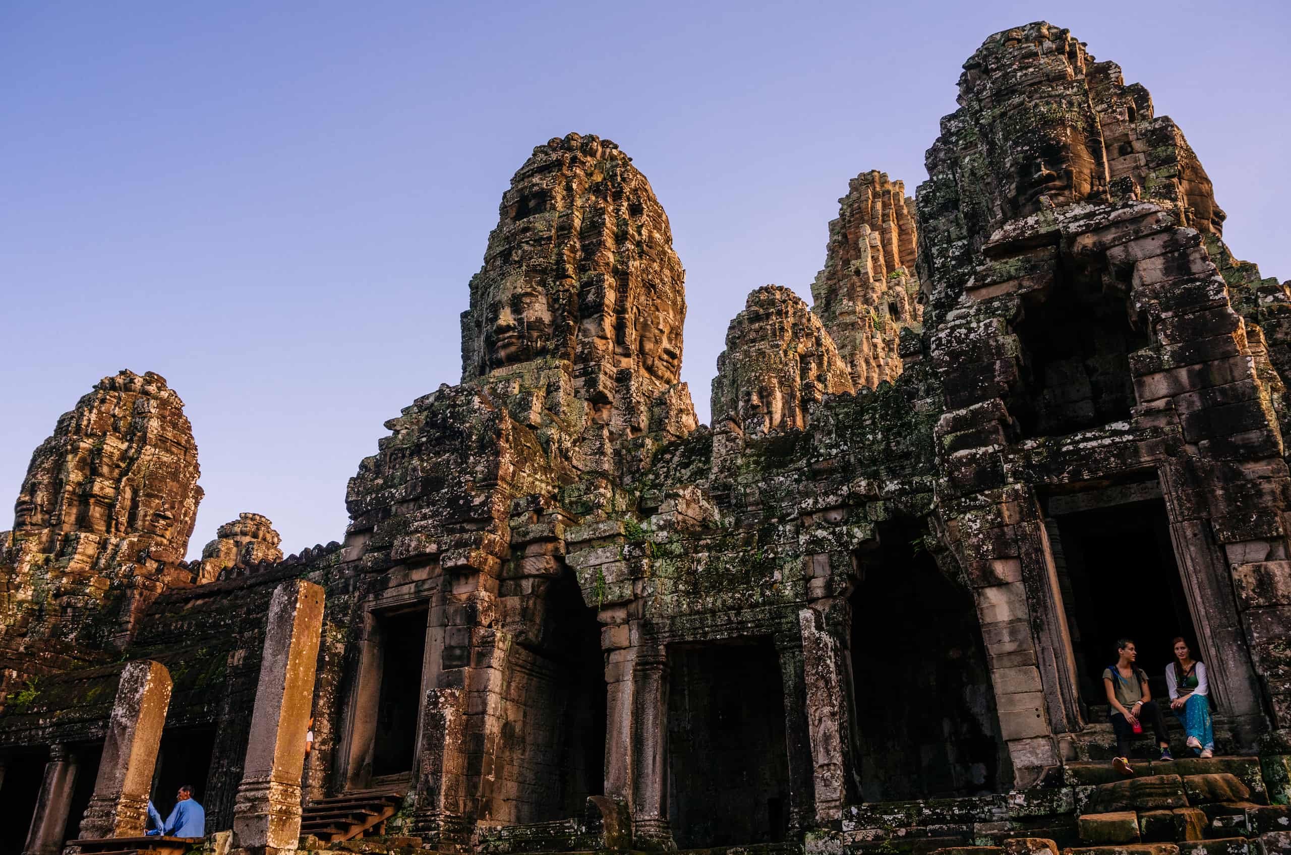
Bayon Temple at Sunset
Bayon Temple was built in the late twelfth or early thirteenth century by King Jayavarman VII and stands at the center of his capital, Angkor Thom, in modern day Siem Reap, Cambodia.
Featured in:
Cambodian Americans, Module 1